
Delwedd:Ellin's Tower and South Stack lighthouse - geograph.org.uk - 1406866.jpg
Wedi ei chwyddo hyd yr eithaf.
Ellin's_Tower_and_South_Stack_lighthouse_-_geograph.org.uk_-_1406866.jpg ((640 × 416 picsel, maint y ffeil: 197 KB, ffurf MIME: image/jpeg))
Crynodeb
| Disgrifiad |
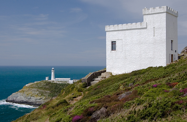
English: Ellin's Tower and South Stack lighthouse The tower, originally built as a folly for the eponymous Ellin, is now an RSPB visitor centre offering binoculars, telescopes and live TV images of guillemots, razorbills and puffins on the cliffside reserve. |
| Dyddiad | |
| Ffynhonnell | From geograph.org.uk |
| Awdur | Paul Harrop |
| Cydnabyddiaeth (required by the license) | Paul Harrop / Ellin's Tower and South Stack lighthouse / |
| Camera location | | View this and other nearby images on: OpenStreetMap |
|---|
_heading:292.00&language=cy)
| Object location | | View this and other nearby images on: OpenStreetMap |
|---|
_heading:292.00&language=cy)
Trwyddedu

|
This image was taken from the Geograph project collection. See this photograph's page on the Geograph website for the photographer's contact details. The copyright on this image is owned by Paul Harrop and is licensed for reuse under the Creative Commons Attribution-ShareAlike 2.0 license.
|
Trwyddedir y ffeil hon yn ôl termau'r drwydded Creative Commons Attribution-Share Alike 2.0 Generic.
Cydnabyddiaeth: Paul Harrop
- Mae'n rhydd i chi:
- rhannu – gallwch gopïo, dosbarthu a throsglwyddo'r gwaith
- ailwampio – gallwch addasu'r gwaith
- Ar yr amodau canlynol:
- cydnabyddiaeth – Mae'n rhaid i chi nodi manylion y gwaith hwn, rhoi dolen i'r drwydded, a nodi os y bu golygu arni, yn y modd a benwyd gan yr awdur neu'r trwyddedwr (ond heb awgrymu o gwbl eu bod yn eich cymeradwyo chi na'ch defnydd o'r gwaith).
- rhannu ar dermau tebyg – Os byddwch yn addasu'r gwaith hwn, neu yn ei drawsnewid, neu yn adeiladu arno, mae'n rhaid i chi ddosbarthu'r gwaith dan drwydded sy'n union yr un fath same a'r gwreiddiol.
Hanes y ffeil
Cliciwch ar ddyddiad / amser i weld y ffeil fel ag yr oedd bryd hynny.
| Dyddiad / Amser | Bawdlun | Hyd a lled | Defnyddiwr | Sylw | |
|---|---|---|---|---|---|
| cyfredol | 12:13, 1 Mawrth 2011 | | 640 × 416 (197 KB) | GeographBot | == {{int:filedesc}} == {{Information |description={{en|1=Ellin's Tower and South Stack lighthouse The tower, originally built as a folly for the eponymous Ellin, is now an RSPB visitor centre offering binoculars, telescopes and live TV images of guillemot |
Cysylltiadau'r ffeil
Mae'r 3 tudalennau a ddefnyddir isod yn cysylltu i'r ddelwedd hon:
Defnydd cydwici y ffeil
Mae'r wicis eraill hyn yn defnyddio'r ffeil hon:
- Y defnydd ar en.wikipedia.org