
Delwedd:EnglandBerkshire.svg

Maint rhagolwg PNG o ffeil SVG yw: 200 × 247 picsel. Eglurdebau eraill: 194 × 240 picsel | 389 × 480 picsel | 622 × 768 picsel | 829 × 1,024 picsel | 1,658 × 2,048 picsel.
Maint llawn (Ffeil SVG, maint mewn enw 200 × 247 picsel, maint y ffeil: 231 KB)
Crynodeb
| Disgrifiad |
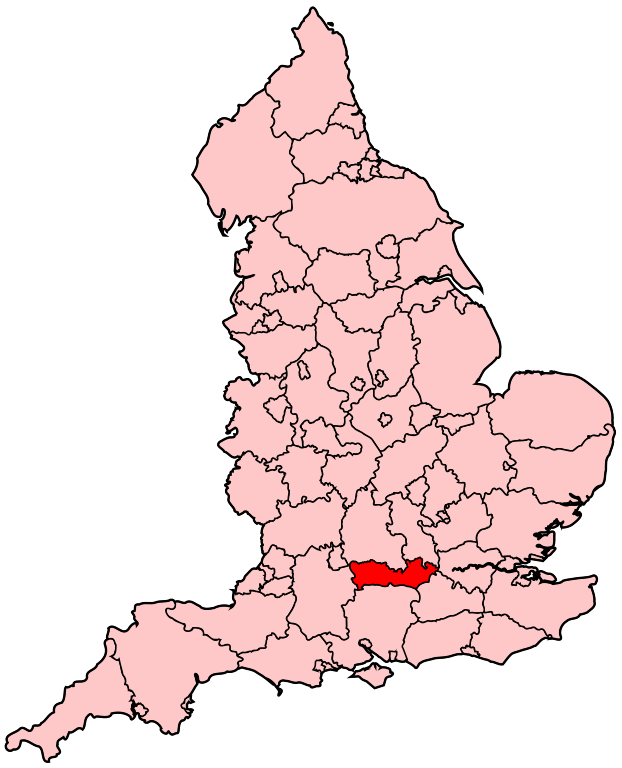
English: Map of the administrative county of Berkshire |
| Ffynhonnell | Gwaith yr uwchlwythwr |
| Awdur | Wereon |
Trwyddedu
| Yr wyf fi, deiliad hawlfraint y gwaith hwn, yn ei ryddhau i'r parth cyhoeddus, a hynny'n fyd-eang. Hwyrach nad yw hyn yn bosib yn ôl cyfraith rhai gwledydd; os felly: Rwyn rhoi i unrhywun yr hawl i ddefnyddio'r gwaith hwn at unrhyw ddiben, heb unrhyw amodau, oddieithr unrhyw amodau gofynnol yn ôl y gyfraith. |
Hanes y ffeil
Cliciwch ar ddyddiad / amser i weld y ffeil fel ag yr oedd bryd hynny.
| Dyddiad / Amser | Bawdlun | Hyd a lled | Defnyddiwr | Sylw | |
|---|---|---|---|---|---|
| cyfredol | 20:05, 22 Ebrill 2007 | | 200 × 247 (231 KB) | Wereon | Map of the administrative county of Berkshire. Category:Maps of counties of England |
Cysylltiadau'r ffeil
Mae mwy na 100 o dudalennau'n yn defnyddio'r ffeil hon. Mae'r rhestr ganlynol yn dangos y 100 tudalen cyntaf sy'n defnyddio'r ffeil hon yn unig. Mae rhestr lawn ar gael.
- Aldermaston
- Aldermaston Wharf
- Aldworth
- Amen Corner, Berkshire
- Anvilles
- Arborfield
- Arborfield Cross
- Arborfield Garrison
- Ascot, Berkshire
- Ashampstead
- Ashampstead Green
- Ashmore Green
- Aston, Berkshire
- Avington, Berkshire
- Bagnor
- Barkham
- Beansheaf Farm
- Beech Hill, Berkshire
- Beedon
- Beedon Common
- Beenham
- Beenham Stocks
- Benham Hill
- Berkshire
- Billingbear
- Binfield
- Birch Hill
- Bisham
- Bloomfield Hatch
- Bothampstead
- Bowsey Hill
- Boxford, Berkshire
- Boyn Hill
- Bracknell
- Bradfield, Berkshire
- Brands Hill
- Bray, Berkshire
- Bray Wick
- Braywoodside
- Brightwalton
- Brightwalton Green
- Brimpton
- Brimpton Common
- Brock Hill
- Brookside, Berkshire
- Bucklebury
- Bullbrook
- Burchetts Green
- Burghfield
- Burghfield Bridge
- Burleigh, Berkshire
- Calcot, Berkshire
- California, Berkshire
- Castell Windsor
- Catmore
- Caversham, Berkshire
- Caversham Heights
- Caversham Park Village
- Chaddleworth
- Chapel Row
- Charvil
- Chavey Down
- Cheapside, Berkshire
- Chieveley
- Clewer
- Cockpole Green
- Cold Ash
- Coleg Eton
- College Town, Berkshire
- Colnbrook
- Colnbrook with Poyle
- Colthrop
- Combe, Berkshire
- Compton, Berkshire
- Cookham
- Cookham Dean
- Cox Green, Berkshire
- Cranbourne, Berkshire
- Crazies Hill
- Crockham Heath
- Crookham, Berkshire
- Crown Wood
- Curridge
- Datchet
- Dedworth
- Donnington, Berkshire
- Downend, Berkshire
- Earley
- East Garston
- East Ilsley
- Eton
- Hungerford
- Maidenhead
- Newbury, Berkshire
- Reading
- Sandhurst, Berkshire
- Slough
- Thatcham
- Windsor
- Wokingham
Gweld rhagor o gysylltiadau at y ffeil hon.
Defnydd cydwici y ffeil
Mae'r wicis eraill hyn yn defnyddio'r ffeil hon:
- Y defnydd ar el.wikipedia.org
- Y defnydd ar en.wikipedia.org
- Reading East (UK Parliament constituency)
- Reading West (UK Parliament constituency)
- Newbury (UK Parliament constituency)
- Wokingham (UK Parliament constituency)
- Maidenhead (UK Parliament constituency)
- Slough (UK Parliament constituency)
- Windsor (UK Parliament constituency)
- Bracknell (UK Parliament constituency)
- Windsor and Maidenhead (UK Parliament constituency)
- East Berkshire (UK Parliament constituency)
- Y defnydd ar es.wikipedia.org
- Y defnydd ar fr.wikipedia.org
- Bracknell (circonscription du Parlement britannique)
- Maidenhead (circonscription du Parlement britannique)
- Newbury (circonscription du Parlement britannique)
- Reading East (circonscription du Parlement britannique)
- Reading West (circonscription du Parlement britannique)
- Slough (circonscription du Parlement britannique)
- Windsor (circonscription du Parlement britannique)
- Wokingham (circonscription du Parlement britannique)
- Liste des circonscriptions parlementaires du Sud-Est (région)
- Y defnydd ar id.wikipedia.org
- Y defnydd ar ko.wikipedia.org
- Y defnydd ar pl.wikipedia.org
- Y defnydd ar ru.wikipedia.org
- Y defnydd ar simple.wikipedia.org
- Y defnydd ar uk.wikipedia.org
- Y defnydd ar zh.wikipedia.org