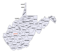
Delwedd:West Virginia counties map.png

Maint y rhagolwg: 667 × 600 picsel. Eglurdebau eraill: 267 × 240 picsel | 534 × 480 picsel | 865 × 778 picsel.
Maint llawn ((865 × 778 picsel, maint y ffeil: 41 KB, ffurf MIME: image/png))
Hanes y ffeil
Cliciwch ar ddyddiad / amser i weld y ffeil fel ag yr oedd bryd hynny.
| Dyddiad / Amser | Bawdlun | Hyd a lled | Defnyddiwr | Sylw | |
|---|---|---|---|---|---|
| cyfredol | 19:55, 16 Gorffennaf 2015 |  | 865 × 778 (41 KB) | Cmdrjameson | Compressed with pngout. Reduced by 68kB (62% decrease). |
| 13:35, 16 Medi 2007 |  | 865 × 778 (109 KB) | BetacommandBot | Transwiki approved by: w:en:User:Dmcdevit This image was copied from wikipedia:en. The original description was: {{PD-USGov-DOC-Census}}w:en:Category:West Virginia maps === File history === {| class=wikitable ! date/time || username || resoluti |
Cysylltiadau'r ffeil
Mae'r 1 tudalennau a ddefnyddir isod yn cysylltu i'r ddelwedd hon:
Defnydd cydwici y ffeil
Mae'r wicis eraill hyn yn defnyddio'r ffeil hon:
- Y defnydd ar bg.wikipedia.org
- Y defnydd ar en.wikipedia.org
- List of counties in West Virginia
- National Register of Historic Places listings in West Virginia
- Constitution of West Virginia
- Index of West Virginia–related articles
- Outline of West Virginia
- Wikipedia:Today's featured list/October 2017
- Wikipedia:Today's featured list/October 30, 2017
- Wikipedia:Main Page history/2017 October 30
- Y defnydd ar eo.wikipedia.org
- Y defnydd ar frr.wikipedia.org
- Y defnydd ar fr.wikipedia.org
- Y defnydd ar hu.wikipedia.org
- Y defnydd ar hu.wiktionary.org
- Y defnydd ar ja.wikipedia.org
- Y defnydd ar ko.wikipedia.org
- Y defnydd ar sq.wikipedia.org
- Y defnydd ar ur.wikipedia.org
- Y defnydd ar zh.wikipedia.org


