
Delwedd:Sladesbridge - geograph.org.uk - 448578.jpg
Wedi ei chwyddo hyd yr eithaf.
Sladesbridge_-_geograph.org.uk_-_448578.jpg ((640 × 480 picsel, maint y ffeil: 109 KB, ffurf MIME: image/jpeg))
Crynodeb
| Disgrifiad |
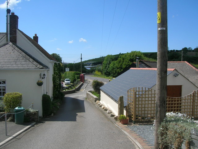
English: Sladesbridge At the telephone box is a junction where the steep lane from Pendavey joins the main Wadebridge to Bodmin road. Trelawney garden centre is just visible on the other side of the road over the River Allen (runs under the road here). |
| Dyddiad | |
| Ffynhonnell | From geograph.org.uk |
| Awdur | William Bartlett |
| Cydnabyddiaeth (required by the license) | William Bartlett / Sladesbridge / |
| Camera location | | View this and other nearby images on: OpenStreetMap |
|---|
_heading:315.00&language=cy)
| Object location | | View this and other nearby images on: OpenStreetMap |
|---|
_heading:315.00&language=cy)
Trwyddedu

|
This image was taken from the Geograph project collection. See this photograph's page on the Geograph website for the photographer's contact details. The copyright on this image is owned by William Bartlett and is licensed for reuse under the Creative Commons Attribution-ShareAlike 2.0 license.
|
Trwyddedir y ffeil hon yn ôl termau'r drwydded Creative Commons Attribution-Share Alike 2.0 Generic.
Cydnabyddiaeth: William Bartlett
- Mae'n rhydd i chi:
- rhannu – gallwch gopïo, dosbarthu a throsglwyddo'r gwaith
- ailwampio – gallwch addasu'r gwaith
- Ar yr amodau canlynol:
- cydnabyddiaeth – Mae'n rhaid i chi nodi manylion y gwaith hwn, rhoi dolen i'r drwydded, a nodi os y bu golygu arni, yn y modd a benwyd gan yr awdur neu'r trwyddedwr (ond heb awgrymu o gwbl eu bod yn eich cymeradwyo chi na'ch defnydd o'r gwaith).
- rhannu ar dermau tebyg – Os byddwch yn addasu'r gwaith hwn, neu yn ei drawsnewid, neu yn adeiladu arno, mae'n rhaid i chi ddosbarthu'r gwaith dan drwydded sy'n union yr un fath same a'r gwreiddiol.
{
Hanes y ffeil
Cliciwch ar ddyddiad / amser i weld y ffeil fel ag yr oedd bryd hynny.
| Dyddiad / Amser | Bawdlun | Hyd a lled | Defnyddiwr | Sylw | |
|---|---|---|---|---|---|
| cyfredol | 12:32, 4 Chwefror 2011 | | 640 × 480 (109 KB) | GeographBot | == {{int:filedesc}} == {{Information |description={{en|1=Sladesbridge At the telephone box is a junction where the steep lane from Pendavey joins the main Wadebridge to Bodmin road. Trelawney garden centre is just visible on the other side of the road ove |
Cysylltiadau'r ffeil
Mae'r 1 tudalennau a ddefnyddir isod yn cysylltu i'r ddelwedd hon:
Defnydd cydwici y ffeil
Mae'r wicis eraill hyn yn defnyddio'r ffeil hon:
- Y defnydd ar en.wikipedia.org
- Y defnydd ar eu.wikipedia.org
- Y defnydd ar pl.wikipedia.org
- Y defnydd ar www.wikidata.org