
Delwedd:Rubbles of the cathedral after the earthquake that hit the Capital Port au Prince just before 5 pm on 12 January 2010.jpg
Maint y rhagolwg: 800 × 533 picsel. Eglurdebau eraill: 320 × 213 picsel | 640 × 427 picsel | 1,024 × 683 picsel | 1,280 × 853 picsel | 3,000 × 2,000 picsel.
Maint llawn ((3,000 × 2,000 picsel, maint y ffeil: 2.35 MB, ffurf MIME: image/jpeg))
Crynodeb
| Disgrifiad |
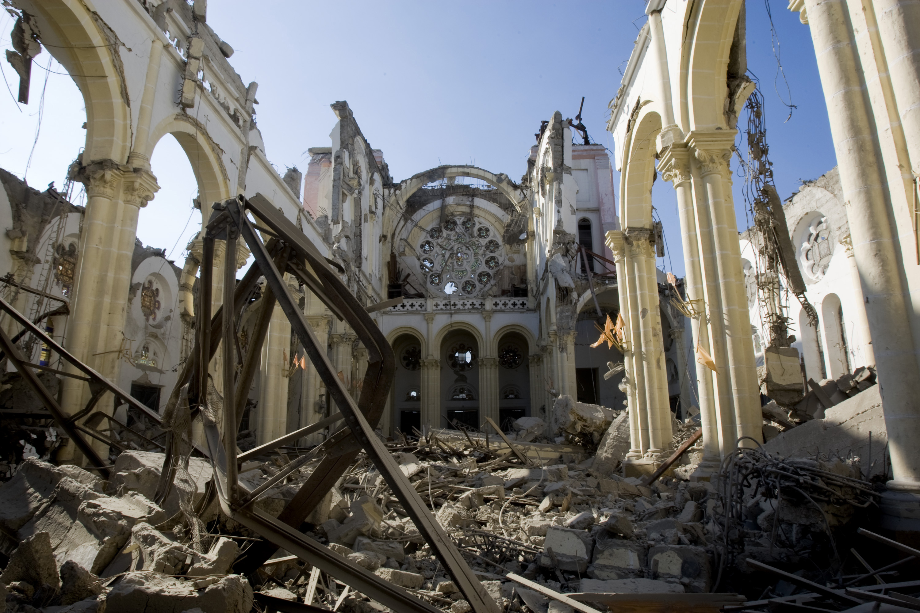
English: Rubbles of the cathedral after the earthquake that hit the Capital Port au Prince just before 5 pm on 12 January 2010
Română: Ruinele catedralei după cutremurul care a zguduit capitala Port au Prince în jurul orei 17 la 12 ianuarie 2010 |
||
| Dyddiad | |||
| Ffynhonnell |
|
||
| Awdur | Marco Dormino | ||
| Caniatâd (Ailddefnyddio'r ffeil hon) |
| Object location | | View this and other nearby images on: OpenStreetMap |
|---|
Trwyddedu
Trwyddedir y ffeil hon yn ôl termau'r drwydded Creative Commons Attribution-ShareAlike 3.0 IGO.
- Mae'n rhydd i chi:
- rhannu – gallwch gopïo, dosbarthu a throsglwyddo'r gwaith
- ailwampio – gallwch addasu'r gwaith
- Ar yr amodau canlynol:
- cydnabyddiaeth – Mae'n rhaid i chi nodi manylion y gwaith hwn, rhoi dolen i'r drwydded, a nodi os y bu golygu arni, yn y modd a benwyd gan yr awdur neu'r trwyddedwr (ond heb awgrymu o gwbl eu bod yn eich cymeradwyo chi na'ch defnydd o'r gwaith).
- rhannu ar dermau tebyg – Os byddwch yn addasu'r gwaith hwn, neu yn ei drawsnewid, neu yn adeiladu arno, mae'n rhaid i chi ddosbarthu'r gwaith dan drwydded sy'n union yr un fath same a'r gwreiddiol.
Hanes y ffeil
Cliciwch ar ddyddiad / amser i weld y ffeil fel ag yr oedd bryd hynny.
| Dyddiad / Amser | Bawdlun | Hyd a lled | Defnyddiwr | Sylw | |
|---|---|---|---|---|---|
| cyfredol | 20:38, 22 Rhagfyr 2014 | | 3,000 × 2,000 (2.35 MB) | John Cummings | higher res |
| 21:15, 19 Rhagfyr 2014 |  | 369 × 246 (68 KB) | John Cummings | User created page with UploadWizard |
Cysylltiadau'r ffeil
Mae'r 1 tudalennau a ddefnyddir isod yn cysylltu i'r ddelwedd hon:
Defnydd cydwici y ffeil
Mae'r wicis eraill hyn yn defnyddio'r ffeil hon:
- Y defnydd ar be.wikimedia.org
- Y defnydd ar ca.wikipedia.org
- Y defnydd ar ca.wikimedia.org
- Y defnydd ar da.wikipedia.org
- Y defnydd ar de.wikipedia.org
- Y defnydd ar de.wikivoyage.org
- Y defnydd ar en.wikipedia.org
- Wikipedia talk:WikiProject Echo
- Cathedral of Our Lady of the Assumption, Port-au-Prince
- Catholic Church in Haiti
- List of Catholic dioceses in Haiti
- Christianity in Haiti
- Wikipedia talk:WikiProject United Nations/Archive 4
- 2010 Haiti earthquake
- Damage to infrastructure in the 2010 Haiti earthquake
- Wikipedia talk:WikiProject International relations/Archive 5
- Wikipedia talk:WikiProject Education/Archive 8
- Wikipedia:Village pump (miscellaneous)/Archive 48
- Wikipedia talk:WikiProject Medicine/Archive 59
- Wikipedia talk:WikiProject World Heritage Sites/Archive 2
- User:John Cummings/Archive/gallery bug
- Y defnydd ar en.wikibooks.org
- Y defnydd ar es.wikipedia.org
- Y defnydd ar es.wikivoyage.org
- Y defnydd ar fa.wikipedia.org
- Y defnydd ar fa.wikivoyage.org
- Y defnydd ar fr.wikipedia.org
- Y defnydd ar fr.wikivoyage.org
- Y defnydd ar gv.wikipedia.org
- Y defnydd ar id.wikipedia.org
- Y defnydd ar it.wikipedia.org
- Y defnydd ar it.wikivoyage.org
- Y defnydd ar ja.wikipedia.org
- Y defnydd ar ko.wikipedia.org
- Y defnydd ar nl.wikimedia.org
- Y defnydd ar nl.wikivoyage.org
- Y defnydd ar pl.wikivoyage.org
- Y defnydd ar pt.wikipedia.org
- Y defnydd ar pt.wikivoyage.org
- Y defnydd ar ru.wikipedia.org
- Y defnydd ar ru.wikivoyage.org
- Y defnydd ar simple.wikipedia.org
Gweld rhagor o'r defnydd cydwici o'r ffeil hon.