
Delwedd:Rg-2005.jpg
Maint y rhagolwg: 701 × 599 picsel. Eglurdebau eraill: 281 × 240 picsel | 561 × 480 picsel | 856 × 732 picsel.
Maint llawn ((856 × 732 picsel, maint y ffeil: 145 KB, ffurf MIME: image/jpeg))
Crynodeb
| Disgrifiad |
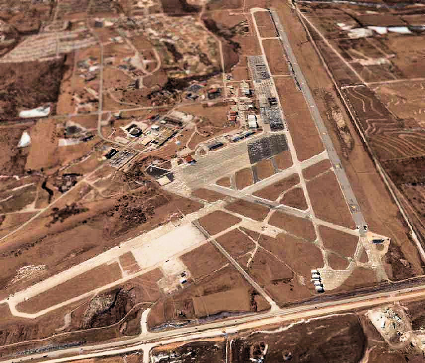
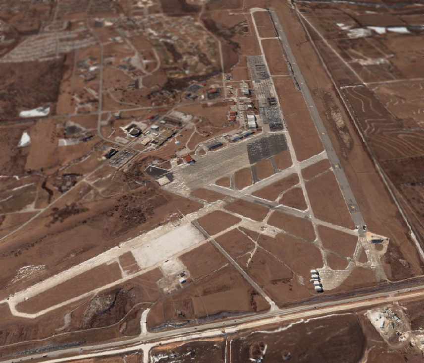
English: A circa 2000-2005 USGS aerial photo looking south at the former Richards-Gebaur AFB, |
| Ffynhonnell | US Geological Survey via http://www.airfields-freeman.com/MO/RichardsGebaur_MO_00_s.jpg |
| Awdur | USGS |
| Caniatâd (Ailddefnyddio'r ffeil hon) |
USGOV-PD |
Trwyddedu
This image is in the public domain in the United States because it only contains materials that originally came from the United States Geological Survey, an agency of the United States Department of the Interior. For more information, see the official USGS copyright policy.
|
Hanes y ffeil
Cliciwch ar ddyddiad / amser i weld y ffeil fel ag yr oedd bryd hynny.
| Dyddiad / Amser | Bawdlun | Hyd a lled | Defnyddiwr | Sylw | |
|---|---|---|---|---|---|
| cyfredol | 13:39, 9 Hydref 2008 | | 856 × 732 (145 KB) | Bwmoll3 | {{Information |Description={{en|1=A circa 2000-2005 USGS aerial photo looking south at the former Richards-Gebaur AFB,}} |Source=US Geological Survey via http://www.airfields-freeman.com/MO/RichardsGebaur_MO_00_s.jpg |Author=USGS |Date= |Permission=USGOV- |
Cysylltiadau'r ffeil
Nid oes tudalennau'n defnyddio'r ffeil hon.
Defnydd cydwici y ffeil
Mae'r wicis eraill hyn yn defnyddio'r ffeil hon:
- Y defnydd ar en.wikipedia.org
- Y defnydd ar hu.wikipedia.org