
Delwedd:NewYork1777MapRestoredSmall.png
Maint y rhagolwg: 458 × 600 picsel. Eglurdebau eraill: 183 × 240 picsel | 367 × 480 picsel | 587 × 768 picsel | 782 × 1,024 picsel | 1,564 × 2,048 picsel | 3,000 × 3,927 picsel.
Maint llawn ((3,000 × 3,927 picsel, maint y ffeil: 15.89 MB, ffurf MIME: image/png))
Crynodeb
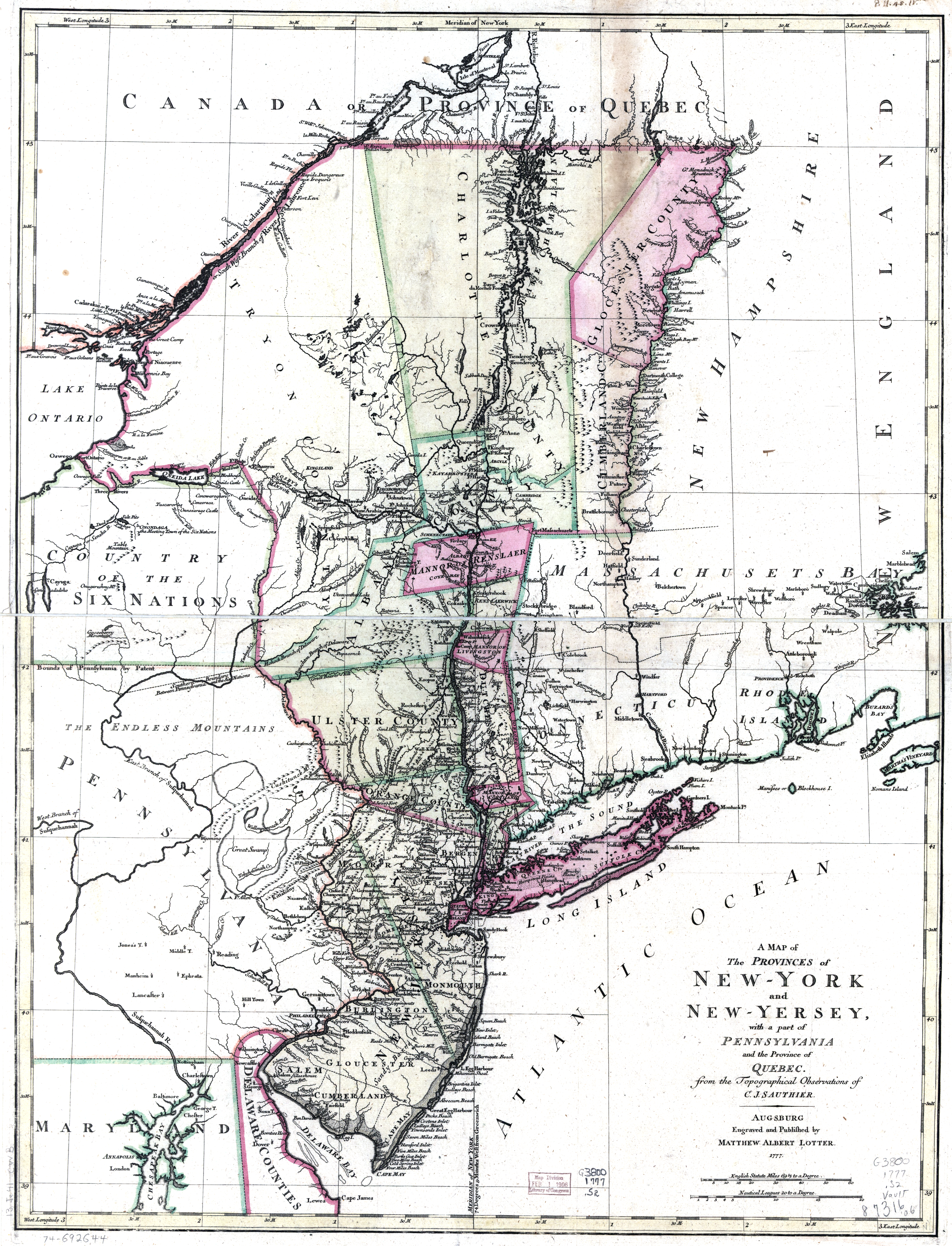
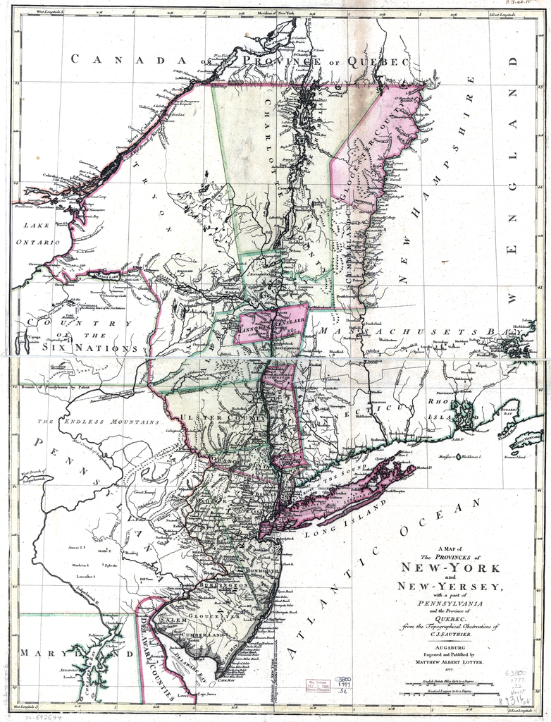
| Disgrifiad | ||||||||||||||||||||
| Dyddiad | ||||||||||||||||||||
| Ffynhonnell | Library of Congress | |||||||||||||||||||
| Awdur |
From topographical observations by
Engraved and published by Matthew Albert Lotter |
|||||||||||||||||||
| Diwygiadau eraill |
|
|||||||||||||||||||


Trwyddedu
This image is in the public domain because it is a mere mechanical scan or photocopy of a public domain original, or – from the available evidence – is so similar to such a scan or photocopy that no copyright protection can be expected to arise. The original itself is in the public domain for the following reason:
This tag is designed for use where there may be a need to assert that any enhancements (eg brightness, contrast, colour-matching, sharpening) are in themselves insufficiently creative to generate a new copyright. It can be used where it is unknown whether any enhancements have been made, as well as when the enhancements are clear but insufficient. For known raw unenhanced scans you can use an appropriate {{PD-old}} tag instead. For usage, see Commons:When to use the PD-scan tag.  |
Hanes y ffeil
Cliciwch ar ddyddiad / amser i weld y ffeil fel ag yr oedd bryd hynny.
| Dyddiad / Amser | Bawdlun | Hyd a lled | Defnyddiwr | Sylw | |
|---|---|---|---|---|---|
| cyfredol | 02:35, 22 Chwefror 2010 | | 3,000 × 3,927 (15.89 MB) | MattWade | ==Summary== {{Information |Description={{en|1=Map of the provinces of New York and New Jersey}} |Source=*File:NewYork1777MapRestored.png |Date=2010-02-22 02:31 (UTC) |Author=*[[:File:NewYor |
Cysylltiadau'r ffeil
Nid oes tudalennau'n defnyddio'r ffeil hon.
Defnydd cydwici y ffeil
Mae'r wicis eraill hyn yn defnyddio'r ffeil hon:
- Y defnydd ar ar.wikipedia.org
- Y defnydd ar bs.wikipedia.org
- Y defnydd ar en.wikipedia.org
- Y defnydd ar ko.wikipedia.org
- Y defnydd ar mk.wikipedia.org
- Y defnydd ar pl.wikipedia.org
- Y defnydd ar pnb.wikipedia.org
- Y defnydd ar ur.wikipedia.org