
Delwedd:Narberth castle from Market square - geograph.org.uk - 529641.jpg
Wedi ei chwyddo hyd yr eithaf.
Narberth_castle_from_Market_square_-_geograph.org.uk_-_529641.jpg ((640 × 492 picsel, maint y ffeil: 91 KB, ffurf MIME: image/jpeg))
Crynodeb
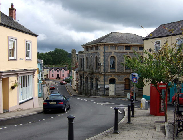
| Disgrifiad |
English: Narberth castle from Market square Looking down Market Street, past the old court house on the right, the eastern part of the castle is visible. Norman, dating from C12, it was burnt/destroyed by the Welsh, and rebuilt, several times before C14. It was inhabited until 1677.
Opened to public access in recent years. |
| Dyddiad | |
| Ffynhonnell | From geograph.org.uk |
| Awdur | ceridwen |
| Cydnabyddiaeth (required by the license) | ceridwen / Narberth castle from Market square / |
| Camera location | | View this and other nearby images on: OpenStreetMap |
|---|
_heading:180.00&language=cy)
| Object location | | View this and other nearby images on: OpenStreetMap |
|---|
_heading:180.00&language=cy)
Trwyddedu

|
This image was taken from the Geograph project collection. See this photograph's page on the Geograph website for the photographer's contact details. The copyright on this image is owned by ceridwen and is licensed for reuse under the Creative Commons Attribution-ShareAlike 2.0 license.
|
Trwyddedir y ffeil hon yn ôl termau'r drwydded Creative Commons Attribution-Share Alike 2.0 Generic.
Cydnabyddiaeth: ceridwen
- Mae'n rhydd i chi:
- rhannu – gallwch gopïo, dosbarthu a throsglwyddo'r gwaith
- ailwampio – gallwch addasu'r gwaith
- Ar yr amodau canlynol:
- cydnabyddiaeth – Mae'n rhaid i chi nodi manylion y gwaith hwn, rhoi dolen i'r drwydded, a nodi os y bu golygu arni, yn y modd a benwyd gan yr awdur neu'r trwyddedwr (ond heb awgrymu o gwbl eu bod yn eich cymeradwyo chi na'ch defnydd o'r gwaith).
- rhannu ar dermau tebyg – Os byddwch yn addasu'r gwaith hwn, neu yn ei drawsnewid, neu yn adeiladu arno, mae'n rhaid i chi ddosbarthu'r gwaith dan drwydded sy'n union yr un fath same a'r gwreiddiol.
Hanes y ffeil
Cliciwch ar ddyddiad / amser i weld y ffeil fel ag yr oedd bryd hynny.
| Dyddiad / Amser | Bawdlun | Hyd a lled | Defnyddiwr | Sylw | |
|---|---|---|---|---|---|
| cyfredol | 16:52, 5 Chwefror 2011 | | 640 × 492 (91 KB) | GeographBot | == {{int:filedesc}} == {{Information |description={{en|1=Narberth castle from Market square Looking down Market Street, past the old court house on the right, the eastern part of the castle is visible. Norman, dating from C12, it was burnt/destroyed by th |
Cysylltiadau'r ffeil
Mae'r 2 tudalennau a ddefnyddir isod yn cysylltu i'r ddelwedd hon:
Defnydd cydwici y ffeil
Mae'r wicis eraill hyn yn defnyddio'r ffeil hon:
- Y defnydd ar bg.wikipedia.org
- Y defnydd ar en.wikivoyage.org
- Y defnydd ar es.wikipedia.org
- Y defnydd ar eu.wikipedia.org
- Y defnydd ar fr.wikipedia.org
- Y defnydd ar ga.wikipedia.org
- Y defnydd ar it.wikipedia.org
- Y defnydd ar www.wikidata.org