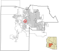
Delwedd:Maricopa County Incorporated and Planning areas Litchfield Park highlighted.svg

Maint rhagolwg PNG o ffeil SVG yw: 694 × 599 picsel. Eglurdebau eraill: 278 × 240 picsel | 556 × 480 picsel | 889 × 768 picsel | 1,185 × 1,024 picsel | 2,371 × 2,048 picsel | 940 × 812 picsel.
Maint llawn (Ffeil SVG, maint mewn enw 940 × 812 picsel, maint y ffeil: 1.05 MB)
Hanes y ffeil
Cliciwch ar ddyddiad / amser i weld y ffeil fel ag yr oedd bryd hynny.
| Dyddiad / Amser | Bawdlun | Hyd a lled | Defnyddiwr | Sylw | |
|---|---|---|---|---|---|
| cyfredol | 06:35, 20 Mai 2011 |  | 940 × 812 (1.05 MB) | Ixnayonthetimmay | Uploading new version |
| 04:21, 30 Awst 2008 |  | 900 × 800 (413 KB) | Ixnayonthetimmay | == Summary == {{Information |Description=This map shows the incorporated areas and unincorporated areas in Maricopa County, Arizona. [[:en:Litchfield Park, A | |
| 23:52, 15 Medi 2007 |  | 900 × 800 (385 KB) | Ixnayonthetimmay | == Summary == {{Information |Description=This map shows the incorporated areas in Maricopa County, Arizona. It also shows the boundaries for the municipal planning areas. The [[:en:Fort | |
| 10:08, 28 Mai 2007 |  | 900 × 780 (329 KB) | Ixnayonthetimmay | ||
| 00:11, 22 Mai 2007 |  | 900 × 780 (318 KB) | Ixnayonthetimmay | ||
| 02:59, 31 Ionawr 2007 |  | 904 × 758 (189 KB) | Ixnayonthetimmay | {{Information |Description=This map shows the incorporated areas in Maricopa County, Arizona, highlighting Litchfield Park in red. It also shows the boun | |
| 05:16, 30 Ionawr 2007 |  | 904 × 758 (189 KB) | Ixnayonthetimmay | {{Information |Description=This map shows the incorporated areas in Maricopa County, Arizona, highlighting Litchfield Park in red. It also shows the boun | |
| 05:16, 30 Ionawr 2007 |  | 904 × 758 (189 KB) | Ixnayonthetimmay | {{Information |Description=This map shows the incorporated areas in Maricopa County, Arizona, highlighting Litchfield Park in red. It also shows the boun |
Cysylltiadau'r ffeil
Mae'r 1 tudalennau a ddefnyddir isod yn cysylltu i'r ddelwedd hon:
Defnydd cydwici y ffeil
Mae'r wicis eraill hyn yn defnyddio'r ffeil hon:
- Y defnydd ar ar.wikipedia.org
- Y defnydd ar arz.wikipedia.org
- Y defnydd ar ca.wikipedia.org
- Y defnydd ar ceb.wikipedia.org
- Y defnydd ar de.wikipedia.org
- Y defnydd ar eu.wikipedia.org
- Y defnydd ar fa.wikipedia.org
- Y defnydd ar fr.wikipedia.org
- Y defnydd ar ht.wikipedia.org
- Y defnydd ar it.wikipedia.org
- Y defnydd ar pt.wikipedia.org
- Y defnydd ar sr.wikipedia.org
- Y defnydd ar tt.wikipedia.org
- Y defnydd ar ur.wikipedia.org
- Y defnydd ar www.wikidata.org
- Y defnydd ar zh-min-nan.wikipedia.org
