
Delwedd:Map of USA AK full.png
Wedi ei chwyddo hyd yr eithaf.
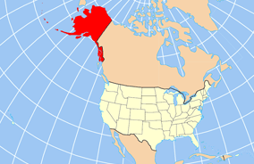
Map_of_USA_AK_full.png ((284 × 184 picsel, maint y ffeil: 19 KB, ffurf MIME: image/png))

|
File:Map of USA AK full.svg is a vector version of this file. It should be used in place of this PNG file when not inferior.
File:Map of USA AK full.png → File:Map of USA AK full.svg
For more information, see Help:SVG. |
 |
Crynodeb
| Disgrifiad | Map of USA with Alaska highlighted and shown in true position |
| Dyddiad | |
| Ffynhonnell | http://www.nationalatlas.gov/printable/reference.html |
| Awdur | |
| Diwygiadau eraill | File:Map of USA AK full.svg |
Trwyddedu
This map was obtained from an edition of the National Atlas of the United States. Like almost all works of the U.S. federal government, works from the National Atlas are in the public domain in the United States.
Online access: NationalAtlas.gov | 1970 print edition: Library of Congress, Perry-Castañeda Library
|
Hanes y ffeil
Cliciwch ar ddyddiad / amser i weld y ffeil fel ag yr oedd bryd hynny.
| Dyddiad / Amser | Bawdlun | Hyd a lled | Defnyddiwr | Sylw | |
|---|---|---|---|---|---|
| cyfredol | 20:43, 17 Rhagfyr 2012 | | 284 × 184 (19 KB) | Ras67 | cropped |
| 16:31, 2 Ebrill 2007 |  | 286 × 186 (20 KB) | MattWright | fix to more standard map colors | |
| 06:20, 2 Ebrill 2007 |  | 286 × 186 (19 KB) | MattWright | {{Information |Description=Map of USA with Alaska highlighted and shown in true position |Source=http://www.nationalatlas.gov/printable/reference.html |Date=2007-04-02 |Author= |Permission= |other_versions= }} Category:Maps of the United States [[Cat |
Cysylltiadau'r ffeil
Mae'r 1 tudalennau a ddefnyddir isod yn cysylltu i'r ddelwedd hon:
Defnydd cydwici y ffeil
Mae'r wicis eraill hyn yn defnyddio'r ffeil hon:
- Y defnydd ar am.wikipedia.org
- Y defnydd ar ar.wikipedia.org
- Y defnydd ar az.wikipedia.org
- Y defnydd ar az.wiktionary.org
- Y defnydd ar ba.wikipedia.org
- Y defnydd ar bn.wikipedia.org
- Y defnydd ar ce.wikipedia.org
- Y defnydd ar da.wikipedia.org
- Y defnydd ar de.wikipedia.org
- Y defnydd ar el.wikipedia.org
- Y defnydd ar en.wikipedia.org
- Y defnydd ar es.wikibooks.org
- Y defnydd ar fa.wikipedia.org
- Y defnydd ar fr.wikinews.org
- Y defnydd ar ga.wikipedia.org
- Sitka
- Buirg Aleutians Thoir, Alasca
- Buirg Anchorage, Alasca
- Buirg Artach Thiar Thuaidh, Alasca
- Buirg Bristol Bay, Alasca
- Buirg Denali, Alasca
- Buirg Fairbanks Réalta Thuaidh, Alasca
- Buirg Haines, Alasca
- Buirg Juneau, Alasca
- Buirg Leithinis Kenai, Alasca
- Buirg Tairseach Ketchikan, Alasca
- Buirg Oileán Kodiak, Alasca
- Buirg Loch agus Leithinis, Alasca
- Buirg Matanuska-Susitna, Alasca
- Buirg Fána Taobh Thuaidh, Alasca
Gweld rhagor o'r defnydd cydwici o'r ffeil hon.