
Delwedd:Hopkins-mo-map.gif
Wedi ei chwyddo hyd yr eithaf.
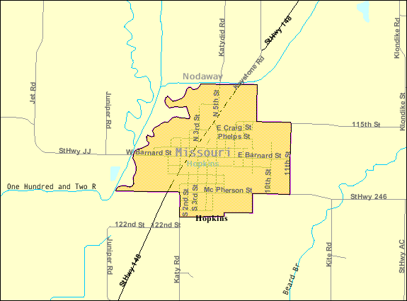
Hopkins-mo-map.gif ((575 × 425 picsel, maint y ffeil: 22 KB, ffurf MIME: image/gif))
Crynodeb

|
Cafwyd y ddelwedd yma ei symud i Gomin Wikimedia o en.wikipedia gan ddefnyddio bot-sgript. Mae'r wybodaeth o'r tarddle'n dal yn bresennol. Ymofynnwyd am adolygiad. Yn ychwanegol, gall gwallau bod yn bresennol o fewn unrhyw neu bob maes; ni ddylid cymryd bod y wybodaeth yn ddibynadwy na defnyddio'r ddelwedd nes iddo gael ei adolygu ac unrhyw newidiadau cael eu hychwanegu os oes angen. Unwaith mae'r adolygiad wedi'i gwblhau, dylech ddiddymu'r nodyn hwn. Am ragor o fanylion, gwelir isod. Adloygu Nawr? |
| Disgrifiad | |
| Dyddiad | |
| Ffynhonnell | http://factfinder.census.gov |
| Awdur | United States Census Bureau |
| Caniatâd (Ailddefnyddio'r ffeil hon) |
Public domain |
Trwyddedu
This image or file is a work of a United States Census Bureau employee, taken or made as part of that person's official duties. As a work of the U.S. federal government, the image is in the public domain.
|
 |
Cofnod lòg yr uwchlwythiad gwreiddiol
Transferred from en.wikipedia to Commons by Milicevic01 using CommonsHelper.
The original description page was here. All following user names refer to en.wikipedia.
- 2007-10-23 19:19 Americasroof 575×425× (22264 bytes) [[Hopkins, Missouri]] map from U.S. Census
Hanes y ffeil
Cliciwch ar ddyddiad / amser i weld y ffeil fel ag yr oedd bryd hynny.
| Dyddiad / Amser | Bawdlun | Hyd a lled | Defnyddiwr | Sylw | |
|---|---|---|---|---|---|
| cyfredol | 13:37, 23 Awst 2013 | | 575 × 425 (22 KB) | File Upload Bot (Magnus Manske) | Transfered from en.wikipedia by User:Milicevic01 using CommonsHelper |
Cysylltiadau'r ffeil
Mae'r 1 tudalennau a ddefnyddir isod yn cysylltu i'r ddelwedd hon:
Defnydd cydwici y ffeil
Mae'r wicis eraill hyn yn defnyddio'r ffeil hon:
- Y defnydd ar ar.wikipedia.org
- Y defnydd ar arz.wikipedia.org
- Y defnydd ar azb.wikipedia.org
- Y defnydd ar ca.wikipedia.org
- Y defnydd ar ceb.wikipedia.org
- Y defnydd ar ce.wikipedia.org
- Y defnydd ar en.wikipedia.org
- Y defnydd ar es.wikipedia.org
- Y defnydd ar eu.wikipedia.org
- Y defnydd ar fa.wikipedia.org
- Y defnydd ar fr.wikipedia.org
- Y defnydd ar ht.wikipedia.org
- Y defnydd ar it.wikipedia.org
- Y defnydd ar ky.wikipedia.org
- Y defnydd ar lld.wikipedia.org
- Y defnydd ar pl.wikipedia.org
- Y defnydd ar pt.wikipedia.org
- Y defnydd ar sh.wikipedia.org
- Y defnydd ar sr.wikipedia.org
- Y defnydd ar tr.wikipedia.org
- Y defnydd ar tt.wikipedia.org
- Y defnydd ar uk.wikipedia.org
- Y defnydd ar uz.wikipedia.org
- Y defnydd ar www.wikidata.org
- Y defnydd ar zh-min-nan.wikipedia.org