
Delwedd:Europe mediterranean 1190.jpg

Maint y rhagolwg: 760 × 600 picsel. Eglurdebau eraill: 304 × 240 picsel | 608 × 480 picsel | 973 × 768 picsel | 1,280 × 1,010 picsel | 2,293 × 1,810 picsel.
Maint llawn ((2,293 × 1,810 picsel, maint y ffeil: 834 KB, ffurf MIME: image/jpeg))
Crynodeb
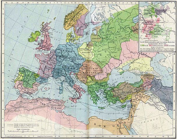
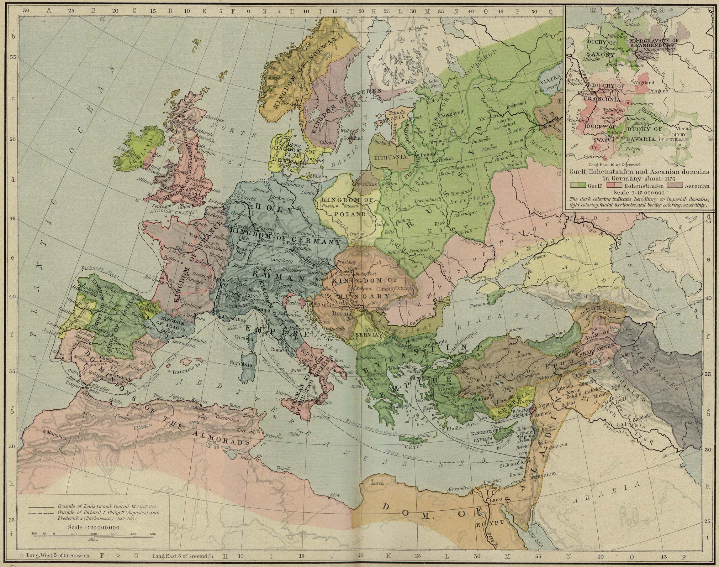
| Disgrifiad | Europa en 1190. |
| Dyddiad | |
| Ffynhonnell | Perry-Castañeda Library, Map Collection: From the "Historical Atlas" by William R. Shepherd, New York, Henry Holt and Company, 1923 |
| Awdur | Roke |
| Diwygiadau eraill | العربيَّة |
.jpg)
.jpg)
_en.png)
.png)
.jpg)
Trwyddedu
|
This work is in the public domain in its country of origin and other countries and areas where the copyright term is the author's life plus 70 years or fewer. This work is in the public domain in the United States because it was published (or registered with the U.S. Copyright Office) before January 1, 1929. | |
| Canfyddwyd bod y ffeil yn rhydd o gyfyngiadau yn ôl cyfraith hawlfraint, gan gynnwys pob hawl perthynol a chyfagos. | |
Hanes y ffeil
Cliciwch ar ddyddiad / amser i weld y ffeil fel ag yr oedd bryd hynny.
| Dyddiad / Amser | Bawdlun | Hyd a lled | Defnyddiwr | Sylw | |
|---|---|---|---|---|---|
| cyfredol | 15:46, 28 Mai 2011 | | 2,293 × 1,810 (834 KB) | Reddi~commonswiki | |
| 10:30, 8 Mai 2006 |  | 2,293 × 1,810 (667 KB) | Roke~commonswiki | Europe in 1190 {{Europe}} {{PD-PCL|http://www.lib.utexas.edu/maps/historical/shepherd/europe_mediterranean_1190.jpg}} Category: Historical maps of Europe |
Cysylltiadau'r ffeil
Mae'r 1 tudalennau a ddefnyddir isod yn cysylltu i'r ddelwedd hon:
Defnydd cydwici y ffeil
Mae'r wicis eraill hyn yn defnyddio'r ffeil hon:
- Y defnydd ar azb.wikipedia.org
- Y defnydd ar az.wikipedia.org
- Y defnydd ar ca.wikipedia.org
- Y defnydd ar cs.wikipedia.org
- Y defnydd ar da.wikipedia.org
- Y defnydd ar de.wikipedia.org
- Y defnydd ar el.wikipedia.org
- Y defnydd ar en.wikipedia.org
- Y defnydd ar en.wikibooks.org
- Y defnydd ar eo.wikipedia.org
- Y defnydd ar es.wikipedia.org
- Y defnydd ar et.wikipedia.org
- Y defnydd ar fa.wikipedia.org
Gweld rhagor o'r defnydd cydwici o'r ffeil hon.