
Delwedd:Daventry UK locator map.svg

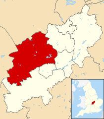
Maint rhagolwg PNG o ffeil SVG yw: 524 × 600 picsel. Eglurdebau eraill: 210 × 240 picsel | 419 × 480 picsel | 671 × 768 picsel | 895 × 1,024 picsel | 1,789 × 2,048 picsel | 1,106 × 1,266 picsel.
Maint llawn (Ffeil SVG, maint mewn enw 1,106 × 1,266 picsel, maint y ffeil: 995 KB)
| Disgrifiad |
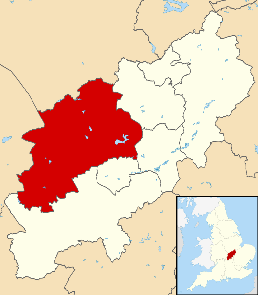
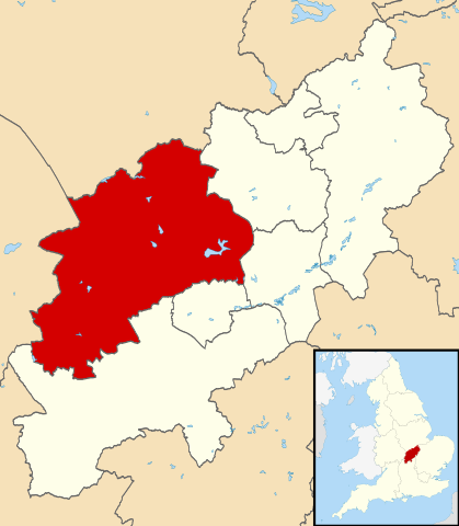
Map of Northamptonshire, UK with Daventry highlighted. Equirectangular map projection on WGS 84 datum, with N/S stretched 160% |
| Dyddiad | |
| Ffynhonnell |
|
| Awdur | Nilfanion, created using Ordnance Survey data |
| Caniatâd (Ailddefnyddio'r ffeil hon) |
Trwyddedir y ffeil hon yn ôl termau'r drwydded Creative Commons Attribution-Share Alike 3.0 Unported. Cydnabyddiaeth: Contains Ordnance Survey data © Crown copyright and database right
|
Hanes y ffeil
Cliciwch ar ddyddiad / amser i weld y ffeil fel ag yr oedd bryd hynny.
| Dyddiad / Amser | Bawdlun | Hyd a lled | Defnyddiwr | Sylw | |
|---|---|---|---|---|---|
| cyfredol | 22:13, 13 Awst 2011 | | 1,106 × 1,266 (995 KB) | Nilfanion | {{Information |Description=Map of Northamptonshire, UK with Daventry highlighted. Equirectangular map projection on WGS 84 datum, with N/S stretched 160% |Source=Ordnance Survey [http |
Cysylltiadau'r ffeil
Mae'r 1 tudalennau a ddefnyddir isod yn cysylltu i'r ddelwedd hon:
Defnydd cydwici y ffeil
Mae'r wicis eraill hyn yn defnyddio'r ffeil hon:
- Y defnydd ar bg.wikipedia.org
- Y defnydd ar en.wikipedia.org
- Long Buckby
- Braunston
- Naseby
- Daventry
- Althorp
- Daventry District
- East Farndon
- Welford, Northamptonshire
- Crick, Northamptonshire
- Arthingworth
- Ashby St Ledgers
- Badby
- Barby, Northamptonshire
- Boughton, Northamptonshire
- Woodford Halse
- Brixworth
- Brockhall, Northamptonshire
- Byfield, Northamptonshire
- Canons Ashby
- Watford, Northamptonshire
- Yelvertoft
- Winwick, Northamptonshire
- Whilton
- West Haddon
- Walgrave
- Upper Catesby
- Thornby, Northamptonshire
- Teeton
- Sulby, Northamptonshire
- Church Stowe
- Staverton, Northamptonshire
- Spratton
- Sibbertoft
- Scaldwell
- Ravensthorpe, Northamptonshire
- Preston Capes
- Pitsford
- Overstone, Northamptonshire
- Old, Northamptonshire
- Norton, Northamptonshire
- Newnham, Northamptonshire
- Moulton, Northamptonshire
- Marston Trussell
- Maidwell
- Kilsby
- Lamport, Northamptonshire
- Lilbourne
- Little Brington
- Lower Catesby
Gweld rhagor o'r defnydd cydwici o'r ffeil hon.