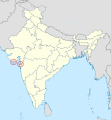
Delwedd:Dadra and Nagar Haveli and Daman and Diu in India (claimed and disputed hatched).svg
Gwedd

Maint rhagolwg PNG o ffeil SVG yw: 557 × 600 picsel. Eglurdebau eraill: 223 × 240 picsel | 446 × 480 picsel | 713 × 768 picsel | 951 × 1,024 picsel | 1,902 × 2,048 picsel | 1,500 × 1,615 picsel.
Maint llawn (Ffeil SVG, maint mewn enw 1,500 × 1,615 picsel, maint y ffeil: 1.67 MB)
Hanes y ffeil
Cliciwch ar ddyddiad / amser i weld y ffeil fel ag yr oedd bryd hynny.
| Dyddiad / Amser | Bawdlun | Hyd a lled | Defnyddiwr | Sylw | |
|---|---|---|---|---|---|
| cyfredol | 17:30, 28 Gorffennaf 2020 |  | 1,500 × 1,615 (1.67 MB) | Unpocoloco | new boundary between Jammu and Kashmir and Ladakh (from 2019) |
| 18:02, 29 Mawrth 2020 |  | 1,500 × 1,615 (1.66 MB) | NordNordWest | == {{int:filedesc}} == {{Information |description={{de|Lage des Unionsterritoriums Dadra und Nagar Haveli und Daman und Diu in Indien}} {{en|Location of the Union territory Dadra and Nagar Haveli and Daman and Diu in India}} |source={{own using}}{{f|Daman and Diu in India (claimed and disputed hatched).svg}} by {{U|TUBS}} |date=2020-03-29 |author={{U|NordNordWest}} |permission= |other_versions={{SVG locator maps (location map scheme)}} }} == {{int:license-header}... |
Cysylltiadau'r ffeil
Nid oes tudalennau'n defnyddio'r ffeil hon.
Defnydd cydwici y ffeil
Mae'r wicis eraill hyn yn defnyddio'r ffeil hon:
- Y defnydd ar af.wikipedia.org
- Y defnydd ar ar.wikipedia.org
- Y defnydd ar bn.wikipedia.org
- Y defnydd ar cs.wikipedia.org
- Y defnydd ar de.wikipedia.org
- Y defnydd ar en.wikivoyage.org
- Y defnydd ar es.wikipedia.org
- Y defnydd ar frr.wikipedia.org
- Y defnydd ar he.wikipedia.org
- Y defnydd ar mzn.wikipedia.org
- Y defnydd ar nn.wikipedia.org
- Y defnydd ar no.wikipedia.org
- Y defnydd ar os.wikipedia.org
- Y defnydd ar pl.wikipedia.org
- Y defnydd ar ro.wikipedia.org
- Y defnydd ar tr.wikipedia.org
- Y defnydd ar ur.wikipedia.org
- Y defnydd ar www.wikidata.org


