
Delwedd:Bayou des Allemands.jpg
Maint y rhagolwg: 800 × 533 picsel. Eglurdebau eraill: 320 × 213 picsel | 640 × 427 picsel | 1,024 × 683 picsel | 1,500 × 1,000 picsel.
Maint llawn ((1,500 × 1,000 picsel, maint y ffeil: 333 KB, ffurf MIME: image/jpeg))
| Disgrifiad |
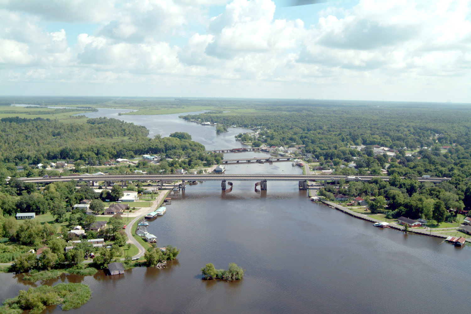
English: Bayou des Allemands and the town of Des Allemands, Louisiana, USA. The bayou is the boundary between St. Charles Parish (right) and Lafourche Parish (left). The three bridges crossing the bayou are (farthest to closest): A railroad bridge, Louisiana State Route 631, and U.S. Route 90. View is to the north. |
|||
| Dyddiad | ||||
| Ffynhonnell |
U.S. Army Corps of Engineers Digital Visual Library Image page Image description page Digital Visual Library home page |
|||
| Awdur | Lane Lefort, U.S. Army Corps of Engineers | |||
| Caniatâd (Ailddefnyddio'r ffeil hon) |
|
|||
| Lleoliad | Des Allemands, Louisiana, USA |
| Camera location | | View this and other nearby images on: OpenStreetMap |
|---|
Hanes y ffeil
Cliciwch ar ddyddiad / amser i weld y ffeil fel ag yr oedd bryd hynny.
| Dyddiad / Amser | Bawdlun | Hyd a lled | Defnyddiwr | Sylw | |
|---|---|---|---|---|---|
| cyfredol | 22:41, 7 Ebrill 2007 | | 1,500 × 1,000 (333 KB) | DanMS | {{Information | Description = {{en|Bayou des Allemands and the town of Des Allemands, Louisiana, USA. The bayou is the boundary between St. Charles Parish (right) and Lafourche Parish (left). The three bridges crossing the bayou are (farthest to closes |
Cysylltiadau'r ffeil
Mae'r 1 tudalennau a ddefnyddir isod yn cysylltu i'r ddelwedd hon:
Defnydd cydwici y ffeil
Mae'r wicis eraill hyn yn defnyddio'r ffeil hon:
- Y defnydd ar ar.wikipedia.org
- Y defnydd ar ca.wikipedia.org
- Y defnydd ar ceb.wikipedia.org
- Y defnydd ar ce.wikipedia.org
- Y defnydd ar de.wikipedia.org
- Y defnydd ar en.wikipedia.org
- Y defnydd ar es.wikipedia.org
- Y defnydd ar fa.wikipedia.org
- Y defnydd ar fr.wikipedia.org
- Y defnydd ar fy.wikipedia.org
- Y defnydd ar it.wikipedia.org
- Y defnydd ar lld.wikipedia.org
- Y defnydd ar nl.wikipedia.org
- Y defnydd ar pl.wikipedia.org
- Y defnydd ar pt.wikipedia.org
- Y defnydd ar sh.wikipedia.org
- Y defnydd ar sr.wikipedia.org
- Y defnydd ar th.wikipedia.org
- Y defnydd ar tt.wikipedia.org
- Y defnydd ar uk.wikipedia.org
- Y defnydd ar www.wikidata.org
- Y defnydd ar zh-min-nan.wikipedia.org
- Y defnydd ar zh.wikipedia.org