
Delwedd:Anatahan aerial.jpg
Wedi ei chwyddo hyd yr eithaf.
Anatahan_aerial.jpg ((640 × 400 picsel, maint y ffeil: 29 KB, ffurf MIME: image/jpeg))
Crynodeb
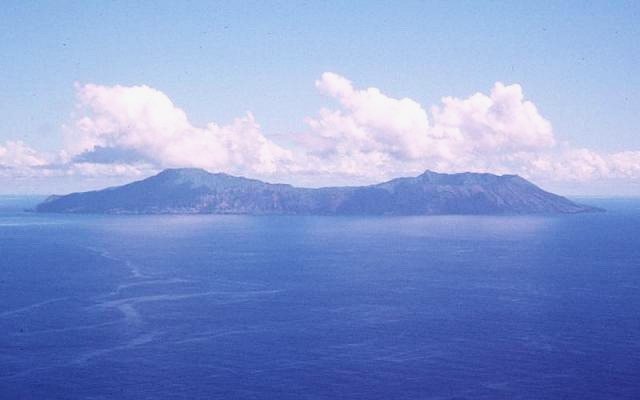
| Disgrifiad |
Deutsch: Luftaufnahme der Insel Anatahan in den Nördlichen Marianen
English: Aerial view of Anatahan Island in the Northern Mariana Islands |
| Dyddiad | |
| Ffynhonnell | http://www.volcano.si.edu/world/volcano.cfm?vnum=0804-20=&volpage=photos&photo=108082 |
| Awdur | U.S. Geological Survey |
Trwyddedu
This image is in the public domain in the United States because it only contains materials that originally came from the United States Geological Survey, an agency of the United States Department of the Interior. For more information, see the official USGS copyright policy.
|
Hanes y ffeil
Cliciwch ar ddyddiad / amser i weld y ffeil fel ag yr oedd bryd hynny.
| Dyddiad / Amser | Bawdlun | Hyd a lled | Defnyddiwr | Sylw | |
|---|---|---|---|---|---|
| cyfredol | 04:51, 28 Chwefror 2008 | | 640 × 400 (29 KB) | Peko | {{Information |Description=Aerial view of Anatahan Island. |Source=http://www.volcano.si.edu/world/volcano.cfm?vnum=0804-20=&volpage=photos&photo=108082 |Date=1994 |Author=USGS |Permission=PD |other_versions= }} |
Cysylltiadau'r ffeil
Mae'r 1 tudalennau a ddefnyddir isod yn cysylltu i'r ddelwedd hon:
Defnydd cydwici y ffeil
Mae'r wicis eraill hyn yn defnyddio'r ffeil hon:
- Y defnydd ar arz.wikipedia.org
- Y defnydd ar ast.wikipedia.org
- Y defnydd ar ceb.wikipedia.org
- Y defnydd ar de.wikipedia.org
- Y defnydd ar en.wikipedia.org
- Y defnydd ar es.wikipedia.org
- Y defnydd ar et.wikipedia.org
- Y defnydd ar fa.wikipedia.org
- Y defnydd ar fi.wikipedia.org
- Y defnydd ar fr.wikipedia.org
- Y defnydd ar gl.wikipedia.org
- Y defnydd ar hy.wikipedia.org
- Y defnydd ar id.wikipedia.org
- Y defnydd ar it.wikipedia.org
- Y defnydd ar ja.wikipedia.org
- Y defnydd ar ko.wikipedia.org
- Y defnydd ar lld.wikipedia.org
- Y defnydd ar ml.wikipedia.org
- Y defnydd ar ms.wikipedia.org
- Y defnydd ar nl.wikipedia.org
- Y defnydd ar no.wikipedia.org
- Y defnydd ar pt.wikipedia.org
- Y defnydd ar ru.wikipedia.org
- Y defnydd ar sr.wikipedia.org
- Y defnydd ar sv.wikipedia.org
- Y defnydd ar th.wikipedia.org
- Y defnydd ar uk.wikipedia.org
- Y defnydd ar ur.wikipedia.org
- Y defnydd ar vi.wikipedia.org
- Y defnydd ar www.wikidata.org
- Y defnydd ar zh.wikipedia.org