
Delwedd:2009-05-13 Damavand from Abbasabad 08.jpg
Maint y rhagolwg: 800 × 205 picsel. Eglurdebau eraill: 320 × 82 picsel | 640 × 164 picsel | 1,024 × 263 picsel | 1,280 × 328 picsel | 5,726 × 1,469 picsel.
Maint llawn ((5,726 × 1,469 picsel, maint y ffeil: 2.13 MB, ffurf MIME: image/jpeg))
Assessment
|
| Disgrifiad |
|
||
| Dyddiad | |||
| Ffynhonnell |
Gwaith yr uwchlwythwr of Simisa (sgwrs · cyfraniadau)
|
||
| Awdur | Hansueli Krapf | ||
| Caniatâd (Ailddefnyddio'r ffeil hon) |
Attribution ShareAlike 3.0 |

| Camera location | | View this and other nearby images on: OpenStreetMap |
|---|
Trwyddedir y ffeil hon yn ôl termau'r drwydded Creative Commons Attribution-Share Alike 3.0 Unported.
- Mae'n rhydd i chi:
- rhannu – gallwch gopïo, dosbarthu a throsglwyddo'r gwaith
- ailwampio – gallwch addasu'r gwaith
- Ar yr amodau canlynol:
- cydnabyddiaeth – Mae'n rhaid i chi nodi manylion y gwaith hwn, rhoi dolen i'r drwydded, a nodi os y bu golygu arni, yn y modd a benwyd gan yr awdur neu'r trwyddedwr (ond heb awgrymu o gwbl eu bod yn eich cymeradwyo chi na'ch defnydd o'r gwaith).
- rhannu ar dermau tebyg – Os byddwch yn addasu'r gwaith hwn, neu yn ei drawsnewid, neu yn adeiladu arno, mae'n rhaid i chi ddosbarthu'r gwaith dan drwydded sy'n union yr un fath same a'r gwreiddiol.
Hanes y ffeil
Cliciwch ar ddyddiad / amser i weld y ffeil fel ag yr oedd bryd hynny.
| Dyddiad / Amser | Bawdlun | Hyd a lled | Defnyddiwr | Sylw | |
|---|---|---|---|---|---|
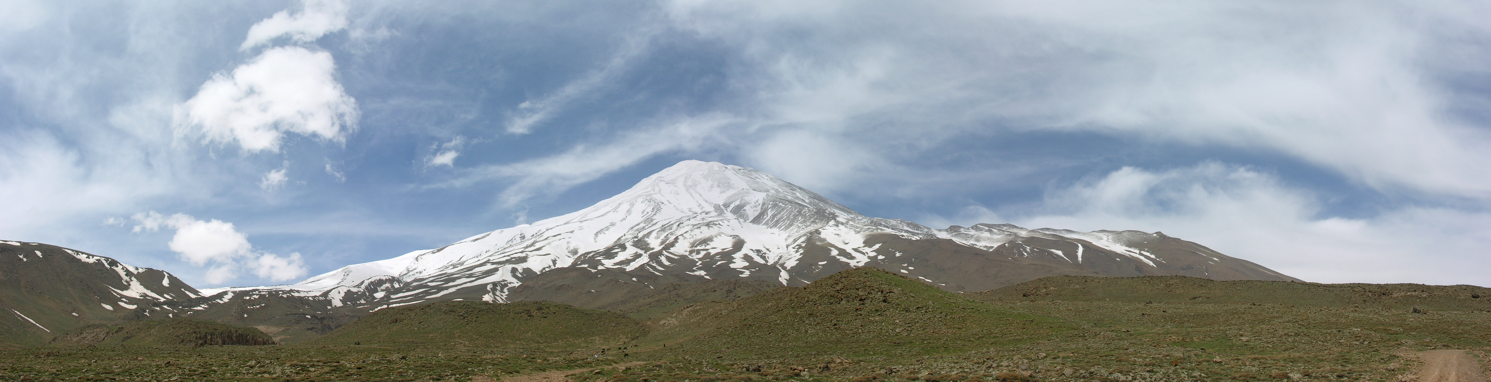
| cyfredol | 12:48, 12 Gorffennaf 2009 | 5,726 × 1,469 (2.13 MB) | Simisa | {{Information |Description={{IRN}}, Damavand from Abbasabad |Source={{Own}} of {{User|Simisa}} {{Panorama|category=}} |Date=see metadata |Author=Hansueli Krapf |Permission=Attribution ShareAlike 3.0 |other_versions= }} {{cc-by-sa-3.0}} |
Cysylltiadau'r ffeil
Mae'r 1 tudalennau a ddefnyddir isod yn cysylltu i'r ddelwedd hon:
Defnydd cydwici y ffeil
Mae'r wicis eraill hyn yn defnyddio'r ffeil hon:
- Y defnydd ar ar.wikipedia.org
- Y defnydd ar av.wikipedia.org
- Y defnydd ar ba.wikipedia.org
- Y defnydd ar fa.wikipedia.org
- دماوند
- ویکیپدیا:نگارههای برگزیده/جاها/طبیعت
- درگاه:طبرستان
- ویکیپدیا:نگاره روز/ژوئیه ۲۰۱۶
- ویکیپدیا:گزیدن نگاره برگزیده/2009-05-13 Damavand from Abbasabad 08.jpg
- الگو:نر/2016-07-26
- الگو:نر محافظت شده/2016-07-26
- درگاه:آمل
- درگاه:آمل/سراسرنما/۱
- درگاه:طبرستان/سراسرنما
- درگاه:طبرستان/سراسرنما/۱
- درگاه:کوهستان
- درگاه:کوهستان/سراسرنمای برگزیده
- درگاه:کوهستان/سراسرنمای برگزیده/۱
- Y defnydd ar fa.wikibooks.org
- Y defnydd ar fi.wikipedia.org
- Y defnydd ar gl.wikipedia.org
- Y defnydd ar incubator.wikimedia.org
- Y defnydd ar ru.wikipedia.org
- Y defnydd ar se.wikipedia.org
- Y defnydd ar sr.wikipedia.org
- Y defnydd ar uk.wikipedia.org
- Y defnydd ar zh.wikipedia.org