
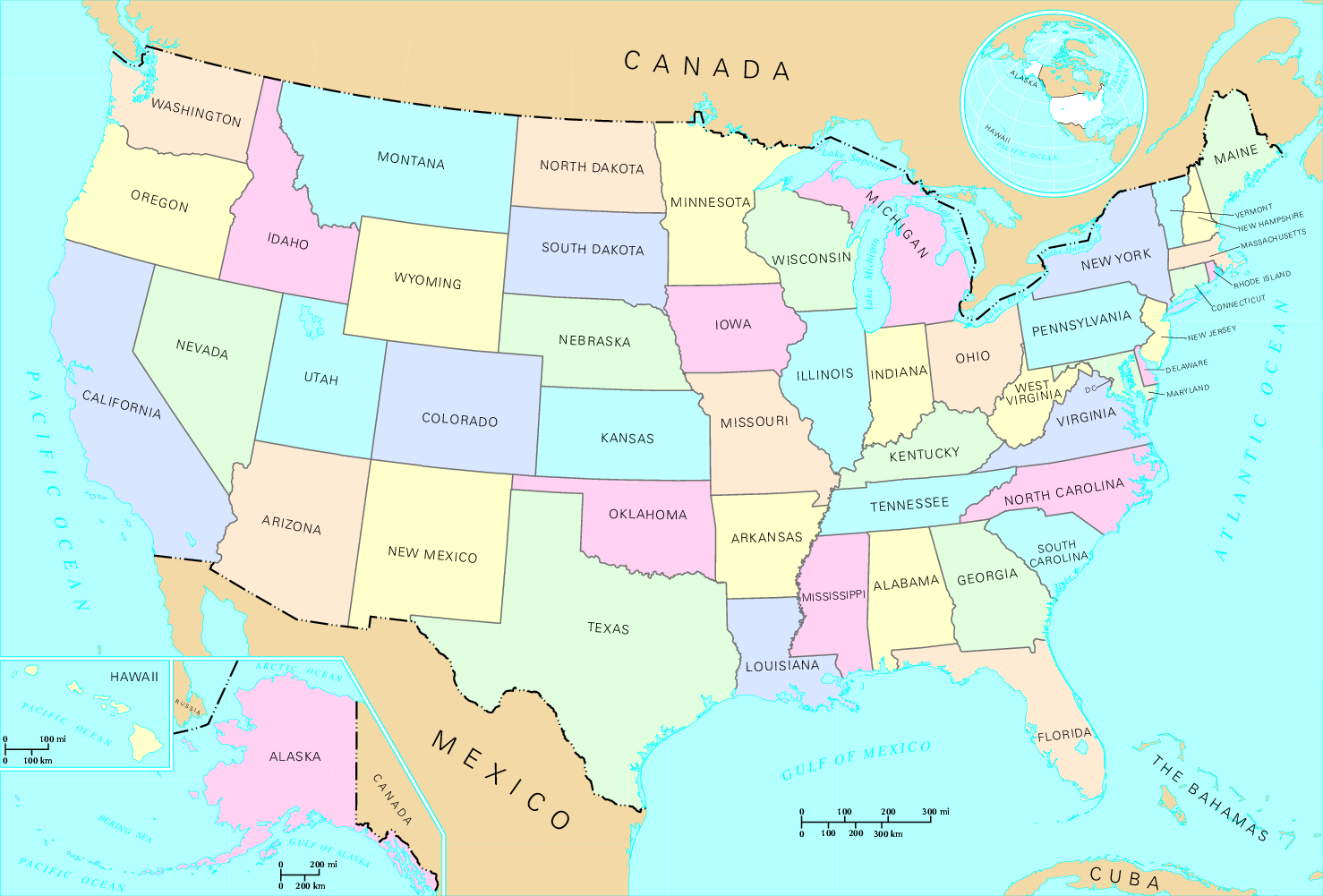
Delwedd:US map - states.png
Maint y rhagolwg: 800 × 542 picsel. Eglurdebau eraill: 320 × 217 picsel | 640 × 433 picsel | 1,024 × 694 picsel | 1,478 × 1,001 picsel.
Maint llawn ((1,478 × 1,001 picsel, maint y ffeil: 356 KB, ffurf MIME: image/png))
| Disgrifiad | States of the United States. | |||
| Ffynhonnell | http://nationalatlas.gov, there also available as PDF | |||
| Awdur | US Department of Interior | |||
| Caniatâd (Ailddefnyddio'r ffeil hon) |
|
|||
| Diwygiadau eraill |
|


List of images provided by user Duesentrieb (This link helps me to find all my images) -- Duesentrieb
Hanes y ffeil
Cliciwch ar ddyddiad / amser i weld y ffeil fel ag yr oedd bryd hynny.
| Dyddiad / Amser | Bawdlun | Hyd a lled | Defnyddiwr | Sylw | |
|---|---|---|---|---|---|
| cyfredol | 15:46, 12 Mai 2008 | | 1,478 × 1,001 (356 KB) | Jon Harald Søby | cropped to remove watermarks |
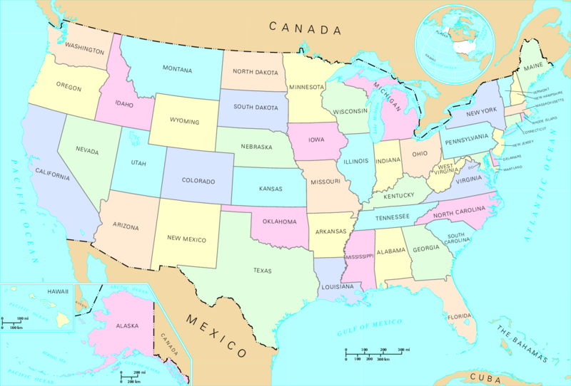
| 15:08, 12 Tachwedd 2004 |  | 1,584 × 1,224 (243 KB) | Duesentrieb | States of the US; Dept. of Interior, Public Domain |
Cysylltiadau'r ffeil
Mae'r 1 tudalennau a ddefnyddir isod yn cysylltu i'r ddelwedd hon:
Defnydd cydwici y ffeil
Mae'r wicis eraill hyn yn defnyddio'r ffeil hon:
- Y defnydd ar bs.wikipedia.org
- Y defnydd ar fr.wikipedia.org
- Y defnydd ar hr.wikipedia.org
- Y defnydd ar nds-nl.wikipedia.org
- Y defnydd ar ro.wikipedia.org
- Y defnydd ar simple.wikipedia.org
- Y defnydd ar simple.wiktionary.org
- Y defnydd ar sl.wikipedia.org
- Y defnydd ar vls.wikipedia.org