
Delwedd:The White Horse public house, Netley Marsh - geograph.org.uk - 68760.jpg
Wedi ei chwyddo hyd yr eithaf.
The_White_Horse_public_house,_Netley_Marsh_-_geograph.org.uk_-_68760.jpg ((640 × 480 picsel, maint y ffeil: 137 KB, ffurf MIME: image/jpeg))
Crynodeb
| Disgrifiad |
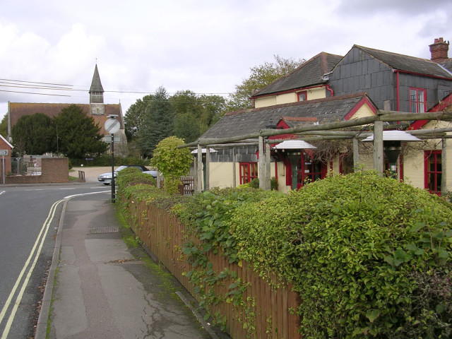
English: The White Horse public house, Netley Marsh. This view is of the side entrance to the White Horse pub, with the parish church in the background on the other side of Ringwood Road (the A336). This junction, where Woodlands Road meets the A336 is the village "centre" with pub, school, church and war memorial. |
| Dyddiad | |
| Ffynhonnell | From geograph.org.uk |
| Awdur | Jim Champion |
| Cydnabyddiaeth (required by the license) | Jim Champion / The White Horse public house, Netley Marsh / |
| Object location | | View this and other nearby images on: OpenStreetMap |
|---|
_&language=cy)
Trwyddedu

|
This image was taken from the Geograph project collection. See this photograph's page on the Geograph website for the photographer's contact details. The copyright on this image is owned by Jim Champion and is licensed for reuse under the Creative Commons Attribution-ShareAlike 2.0 license.
|
Trwyddedir y ffeil hon yn ôl termau'r drwydded Creative Commons Attribution-Share Alike 2.0 Generic.
Cydnabyddiaeth: Jim Champion
- Mae'n rhydd i chi:
- rhannu – gallwch gopïo, dosbarthu a throsglwyddo'r gwaith
- ailwampio – gallwch addasu'r gwaith
- Ar yr amodau canlynol:
- cydnabyddiaeth – Mae'n rhaid i chi nodi manylion y gwaith hwn, rhoi dolen i'r drwydded, a nodi os y bu golygu arni, yn y modd a benwyd gan yr awdur neu'r trwyddedwr (ond heb awgrymu o gwbl eu bod yn eich cymeradwyo chi na'ch defnydd o'r gwaith).
- rhannu ar dermau tebyg – Os byddwch yn addasu'r gwaith hwn, neu yn ei drawsnewid, neu yn adeiladu arno, mae'n rhaid i chi ddosbarthu'r gwaith dan drwydded sy'n union yr un fath same a'r gwreiddiol.
Hanes y ffeil
Cliciwch ar ddyddiad / amser i weld y ffeil fel ag yr oedd bryd hynny.
| Dyddiad / Amser | Bawdlun | Hyd a lled | Defnyddiwr | Sylw | |
|---|---|---|---|---|---|
| cyfredol | 19:58, 30 Ionawr 2010 | | 640 × 480 (137 KB) | GeographBot | == {{int:filedesc}} == {{Information |description={{en|1=The White Horse public house, Netley Marsh. This view is of the side entrance to the White Horse pub, with the parish church in the background on the other side of Ringwood Road (the A336). This jun |
Cysylltiadau'r ffeil
Mae'r 1 tudalennau a ddefnyddir isod yn cysylltu i'r ddelwedd hon:
Defnydd cydwici y ffeil
Mae'r wicis eraill hyn yn defnyddio'r ffeil hon:
- Y defnydd ar ceb.wikipedia.org
- Y defnydd ar en.wikipedia.org
- Y defnydd ar fa.wikipedia.org
- Y defnydd ar fr.wikipedia.org
- Y defnydd ar lld.wikipedia.org
- Y defnydd ar pl.wikipedia.org
- Y defnydd ar www.wikidata.org