
Delwedd:St Andrew's Church, Countesthorpe - geograph.org.uk - 230099.jpg
Wedi ei chwyddo hyd yr eithaf.
St_Andrew's_Church,_Countesthorpe_-_geograph.org.uk_-_230099.jpg ((640 × 427 picsel, maint y ffeil: 123 KB, ffurf MIME: image/jpeg))
Crynodeb
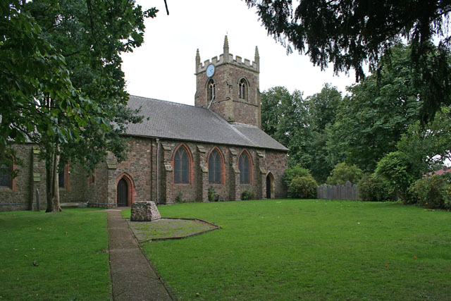
| Disgrifiad |
English: St Andrew's parish church, Countesthorpe, Leicestershire, seen from the northeast |
| Dyddiad | |
| Ffynhonnell | From geograph.org.uk |
| Awdur | Kate Jewell |
| Cydnabyddiaeth (required by the license) | Kate Jewell / St Andrew's Church, Countesthorpe / |
| Camera location | | View this and other nearby images on: OpenStreetMap |
|---|
_heading:180.00&language=cy)
| Object location | | View this and other nearby images on: OpenStreetMap |
|---|
_heading:180.00&language=cy)
Trwyddedu

|
This image was taken from the Geograph project collection. See this photograph's page on the Geograph website for the photographer's contact details. The copyright on this image is owned by Kate Jewell and is licensed for reuse under the Creative Commons Attribution-ShareAlike 2.0 license.
|
Trwyddedir y ffeil hon yn ôl termau'r drwydded Creative Commons Attribution-Share Alike 2.0 Generic.
Cydnabyddiaeth: Kate Jewell
- Mae'n rhydd i chi:
- rhannu – gallwch gopïo, dosbarthu a throsglwyddo'r gwaith
- ailwampio – gallwch addasu'r gwaith
- Ar yr amodau canlynol:
- cydnabyddiaeth – Mae'n rhaid i chi nodi manylion y gwaith hwn, rhoi dolen i'r drwydded, a nodi os y bu golygu arni, yn y modd a benwyd gan yr awdur neu'r trwyddedwr (ond heb awgrymu o gwbl eu bod yn eich cymeradwyo chi na'ch defnydd o'r gwaith).
- rhannu ar dermau tebyg – Os byddwch yn addasu'r gwaith hwn, neu yn ei drawsnewid, neu yn adeiladu arno, mae'n rhaid i chi ddosbarthu'r gwaith dan drwydded sy'n union yr un fath same a'r gwreiddiol.
Hanes y ffeil
Cliciwch ar ddyddiad / amser i weld y ffeil fel ag yr oedd bryd hynny.
| Dyddiad / Amser | Bawdlun | Hyd a lled | Defnyddiwr | Sylw | |
|---|---|---|---|---|---|
| cyfredol | 02:18, 1 Chwefror 2010 | | 640 × 427 (123 KB) | GeographBot | == {{int:filedesc}} == {{Information |description={{en|1=St Andrew's Church, Countesthorpe. Built in the early 13th Century this church was restored in 1840 and with further work in 1907. The tower is 14th century.}} |date=2006-08-31 |source=From [http:/ |
Cysylltiadau'r ffeil
Mae'r 1 tudalennau a ddefnyddir isod yn cysylltu i'r ddelwedd hon:
Defnydd cydwici y ffeil
Mae'r wicis eraill hyn yn defnyddio'r ffeil hon:
- Y defnydd ar ceb.wikipedia.org
- Y defnydd ar de.wikipedia.org
- Y defnydd ar en.wikipedia.org
- Y defnydd ar es.wikipedia.org
- Y defnydd ar fr.wikipedia.org
- Y defnydd ar it.wikipedia.org
- Y defnydd ar lld.wikipedia.org
- Y defnydd ar nl.wikipedia.org
- Y defnydd ar pl.wikipedia.org
- Y defnydd ar www.wikidata.org