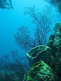
Delwedd:Reef 247.jpg

Maint y rhagolwg: 450 × 600 picsel. Eglurdebau eraill: 180 × 240 picsel | 360 × 480 picsel | 576 × 768 picsel | 768 × 1,024 picsel | 2,112 × 2,816 picsel.
Maint llawn ((2,112 × 2,816 picsel, maint y ffeil: 1.69 MB, ffurf MIME: image/jpeg))
Hanes y ffeil
Cliciwch ar ddyddiad / amser i weld y ffeil fel ag yr oedd bryd hynny.
| Dyddiad / Amser | Bawdlun | Hyd a lled | Defnyddiwr | Sylw | |
|---|---|---|---|---|---|
| cyfredol | 07:48, 1 Ebrill 2009 |  | 2,112 × 2,816 (1.69 MB) | Monfornot | Rotated |
| 07:46, 1 Ebrill 2009 |  | 2,816 × 2,112 (1.53 MB) | Monfornot | {{Information |Description= Photo by Lauretta Burke, World Resources Institute, 2007. Taken in the Soufriere area of St. Lucia. The Economic Valuation of Coral Reefs project aims to use valuation estimates to improve the management of coral reef ecosyst |
Cysylltiadau'r ffeil
Mae'r 1 tudalennau a ddefnyddir isod yn cysylltu i'r ddelwedd hon:
Defnydd cydwici y ffeil
Mae'r wicis eraill hyn yn defnyddio'r ffeil hon:
- Y defnydd ar ar.wikipedia.org
- Y defnydd ar az.wikipedia.org
- Y defnydd ar en.wikipedia.org
- Y defnydd ar es.wikipedia.org
- Y defnydd ar eu.wikipedia.org
- Y defnydd ar glk.wikipedia.org
- Y defnydd ar hy.wikipedia.org
- Y defnydd ar incubator.wikimedia.org
- Y defnydd ar it.wikipedia.org
- Y defnydd ar nl.wiktionary.org
- Y defnydd ar qu.wikipedia.org
- Y defnydd ar ru.wikipedia.org
- Y defnydd ar tr.wikipedia.org
- Y defnydd ar udm.wikipedia.org
- Y defnydd ar zh-yue.wikipedia.org
- Y defnydd ar zh.wikipedia.org
