
Delwedd:Moreton, the old post office - geograph.org.uk - 1708239.jpg
Wedi ei chwyddo hyd yr eithaf.
Moreton,_the_old_post_office_-_geograph.org.uk_-_1708239.jpg ((640 × 480 picsel, maint y ffeil: 70 KB, ffurf MIME: image/jpeg))
Crynodeb
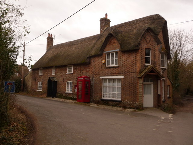
| Disgrifiad |
English: Moreton: the old post office Moreton's village store and post office closed down in the first couple of years of the 2000s, the postbox and telephone confirming the indication perhaps given by the style of window that there was ever a shop here. |
| Dyddiad | |
| Ffynhonnell | From geograph.org.uk |
| Awdur | Chris Downer |
| Cydnabyddiaeth (required by the license) | Chris Downer / Moreton: the old post office / |
| Camera location | | View this and other nearby images on: OpenStreetMap |
|---|
_heading:337.00&language=cy)
| Object location | | View this and other nearby images on: OpenStreetMap |
|---|
_heading:337.00&language=cy)
Trwyddedu

|
This image was taken from the Geograph project collection. See this photograph's page on the Geograph website for the photographer's contact details. The copyright on this image is owned by Chris Downer and is licensed for reuse under the Creative Commons Attribution-ShareAlike 2.0 license.
|
Trwyddedir y ffeil hon yn ôl termau'r drwydded Creative Commons Attribution-Share Alike 2.0 Generic.
Cydnabyddiaeth: Chris Downer
- Mae'n rhydd i chi:
- rhannu – gallwch gopïo, dosbarthu a throsglwyddo'r gwaith
- ailwampio – gallwch addasu'r gwaith
- Ar yr amodau canlynol:
- cydnabyddiaeth – Mae'n rhaid i chi nodi manylion y gwaith hwn, rhoi dolen i'r drwydded, a nodi os y bu golygu arni, yn y modd a benwyd gan yr awdur neu'r trwyddedwr (ond heb awgrymu o gwbl eu bod yn eich cymeradwyo chi na'ch defnydd o'r gwaith).
- rhannu ar dermau tebyg – Os byddwch yn addasu'r gwaith hwn, neu yn ei drawsnewid, neu yn adeiladu arno, mae'n rhaid i chi ddosbarthu'r gwaith dan drwydded sy'n union yr un fath same a'r gwreiddiol.
Hanes y ffeil
Cliciwch ar ddyddiad / amser i weld y ffeil fel ag yr oedd bryd hynny.
| Dyddiad / Amser | Bawdlun | Hyd a lled | Defnyddiwr | Sylw | |
|---|---|---|---|---|---|
| cyfredol | 05:31, 5 Mawrth 2011 | | 640 × 480 (70 KB) | GeographBot | == {{int:filedesc}} == {{Information |description={{en|1=Moreton: the old post office Moreton's village store and post office closed down in the first couple of years of the 2000s, the postbox and telephone confirming the indication perhaps given by the s |
Cysylltiadau'r ffeil
Mae'r 1 tudalennau a ddefnyddir isod yn cysylltu i'r ddelwedd hon:
Defnydd cydwici y ffeil
Mae'r wicis eraill hyn yn defnyddio'r ffeil hon:
- Y defnydd ar ceb.wikipedia.org
- Y defnydd ar en.wikipedia.org
- Y defnydd ar fa.wikipedia.org
- Y defnydd ar fi.wikipedia.org
- Y defnydd ar lld.wikipedia.org
- Y defnydd ar pl.wikipedia.org
- Y defnydd ar www.wikidata.org
- Y defnydd ar zh-min-nan.wikipedia.org