
Delwedd:Dover UK locator map.svg

Maint rhagolwg PNG o ffeil SVG yw: 800 × 561 picsel. Eglurdebau eraill: 320 × 225 picsel | 640 × 449 picsel | 1,024 × 719 picsel | 1,280 × 898 picsel | 2,560 × 1,796 picsel | 1,425 × 1,000 picsel.
Maint llawn (Ffeil SVG, maint mewn enw 1,425 × 1,000 picsel, maint y ffeil: 1.18 MB)
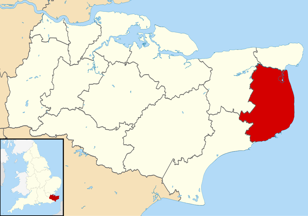
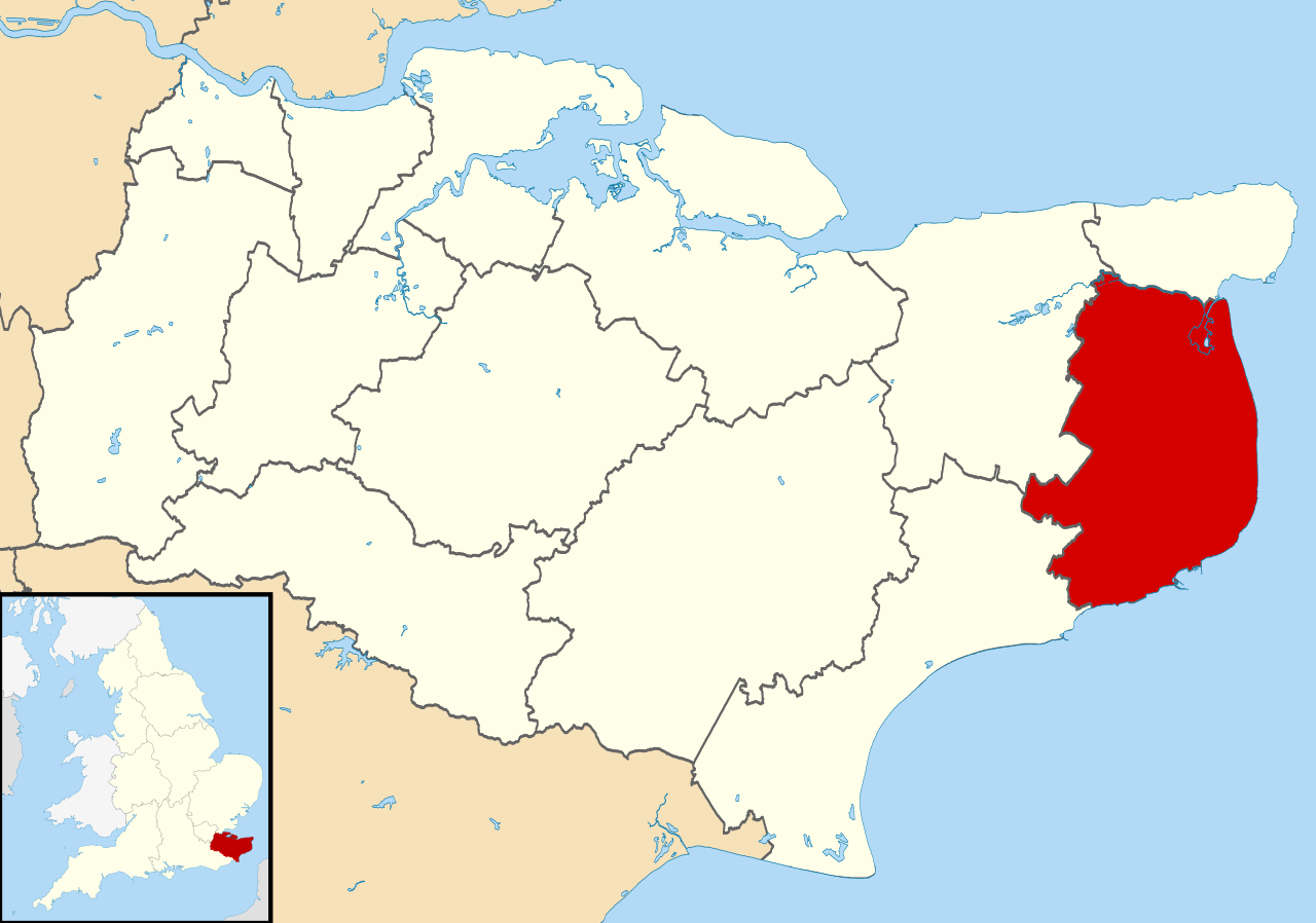
| Disgrifiad | Equirectangular map projection on WGS 84 datum, with N/S stretched 160% |
| Dyddiad | |
| Ffynhonnell |
|
| Awdur | Nilfanion, created using Ordnance Survey data |
| Caniatâd (Ailddefnyddio'r ffeil hon) |
Trwyddedir y ffeil hon yn ôl termau'r drwydded Creative Commons Attribution-Share Alike 3.0 Unported. Cydnabyddiaeth: Contains Ordnance Survey data © Crown copyright and database right
|
Hanes y ffeil
Cliciwch ar ddyddiad / amser i weld y ffeil fel ag yr oedd bryd hynny.
| Dyddiad / Amser | Bawdlun | Hyd a lled | Defnyddiwr | Sylw | |
|---|---|---|---|---|---|
| cyfredol | 09:07, 2 Awst 2011 | | 1,425 × 1,000 (1.18 MB) | Nilfanion | {{Information |Description=Map of Kent, UK with Dover highlighted. Equirectangular map projection on WGS 84 datum, with N/S stretched 160% |Source=Ordnance Survey [https://www.ordnancesurvey.co.uk/o |
Cysylltiadau'r ffeil
Mae'r 1 tudalennau a ddefnyddir isod yn cysylltu i'r ddelwedd hon:
Defnydd cydwici y ffeil
Mae'r wicis eraill hyn yn defnyddio'r ffeil hon:
- Y defnydd ar en.wikipedia.org
- Dover
- Sandwich, Kent
- Walmer
- Eythorne
- Dover District
- East Langdon
- Deal, Kent
- Eastry
- Drellingore
- Kingsdown, Dover
- Maxton, Kent
- Martin, Kent
- Martin Mill
- Coombe, Kent
- Ash, Dover District
- West Langdon
- Wingham, Kent
- Barfrestone
- Kearsney, Kent
- Elvington, Kent
- Capel-le-Ferne
- Richborough
- Lydden
- Whitfield, Kent
- Alkham
- Ripple, Kent
- Aylesham
- Nonington
- Marley, Dover
- Temple Ewell
- Preston-next-Wingham
- River, Kent
- Shepherdswell
- Plucks Gutter
- Template:Towns and villages in Dover district
- St Margaret's at Cliffe
- Sholden
- Tilmanstone
- Buckland, Kent
- Staple, Kent
- Great Mongeham
- User:O1ive/Dover
- Goodnestone, Dover
- Woodnesborough
- Guston, Kent
- Stourmouth
- Ashley, Kent
- Coldred
- Denton, Kent
- East Studdal
Gweld rhagor o'r defnydd cydwici o'r ffeil hon.