
Delwedd:Andes1a.JPG

Maint y rhagolwg: 800 × 595 picsel. Eglurdebau eraill: 320 × 238 picsel | 640 × 476 picsel | 1,024 × 761 picsel | 1,280 × 952 picsel | 1,380 × 1,026 picsel.
Maint llawn ((1,380 × 1,026 picsel, maint y ffeil: 962 KB, ffurf MIME: image/jpeg))
Crynodeb
| Disgrifiad |
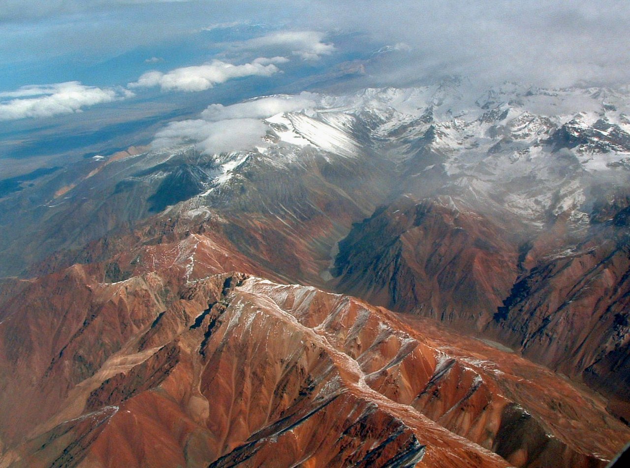
English: The Andes. Photo was taken on a flight between Asuncion, Paraguay and Santiago, Chile, so the exact location is probably in the area between Santiago, Chile and Cordoba, Argentina. This is on the Argentina side. On the left Cordón del Plata, on the right Cordón de la Jaula, between them Quebrada de la Jaula. Cerro Blanco (5127 m a.s.l.) in the foreground. |
| Dyddiad | |
| Ffynhonnell | Wikipedia:Contact us/Photo submission |
| Awdur | Robert Morrow |
| Caniatâd (Ailddefnyddio'r ffeil hon) |
Trwyddedir y ffeil hon yn ôl termau'r drwydded Creative Commons Attribution-Share Alike 3.0 Unported.
|
| Object location | | View this and other nearby images on: OpenStreetMap |
|---|
Hanes y ffeil
Cliciwch ar ddyddiad / amser i weld y ffeil fel ag yr oedd bryd hynny.
| Dyddiad / Amser | Bawdlun | Hyd a lled | Defnyddiwr | Sylw | |
|---|---|---|---|---|---|
| cyfredol | 18:44, 10 Tachwedd 2008 | | 1,380 × 1,026 (962 KB) | Holly Cheng | == Summary == {{Information |Description={{en|1=The Andes. Photo was taken on a flight between Asuncion, Paraguay and Santiago, Chile, so the exact location is probably in the area between Santiago, Chile and Cordoba, Argentina. This is on the Argentina s |
Cysylltiadau'r ffeil
Mae'r 1 tudalennau a ddefnyddir isod yn cysylltu i'r ddelwedd hon:
Defnydd cydwici y ffeil
Mae'r wicis eraill hyn yn defnyddio'r ffeil hon:
- Y defnydd ar ay.wikipedia.org
- Y defnydd ar bs.wikipedia.org
- Y defnydd ar ca.wikipedia.org
- Y defnydd ar cs.wikipedia.org
- Y defnydd ar en.wikipedia.org
- Y defnydd ar et.wikipedia.org
- Y defnydd ar fr.wikipedia.org
- Y defnydd ar gn.wikipedia.org
- Y defnydd ar kk.wikipedia.org
- Y defnydd ar kn.wikipedia.org
- Y defnydd ar ko.wikipedia.org
- Y defnydd ar ky.wikipedia.org
- Y defnydd ar ml.wikipedia.org
- Y defnydd ar oc.wikipedia.org
- Y defnydd ar or.wikipedia.org
- Y defnydd ar simple.wikipedia.org
- Y defnydd ar sr.wikipedia.org
- Y defnydd ar vi.wikipedia.org