
Delwedd:Tewkesbury UK locator map.svg

Maint rhagolwg PNG o ffeil SVG yw: 516 × 600 picsel. Eglurdebau eraill: 206 × 240 picsel | 413 × 480 picsel | 661 × 768 picsel | 881 × 1,024 picsel | 1,762 × 2,048 picsel | 1,089 × 1,266 picsel.
Maint llawn (Ffeil SVG, maint mewn enw 1,089 × 1,266 picsel, maint y ffeil: 1.09 MB)
| Disgrifiad |
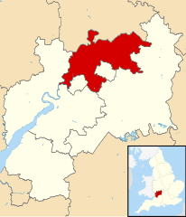
Map of Gloucestershire, UK with Tewkesbury highlighted. Equirectangular map projection on WGS 84 datum, with N/S stretched 160% |
| Dyddiad | |
| Ffynhonnell |
|
| Awdur | Nilfanion, created using Ordnance Survey data |
| Caniatâd (Ailddefnyddio'r ffeil hon) |
Trwyddedir y ffeil hon yn ôl termau'r drwydded Creative Commons Attribution-Share Alike 3.0 Unported. Cydnabyddiaeth: Contains Ordnance Survey data © Crown copyright and database right
|
Hanes y ffeil
Cliciwch ar ddyddiad / amser i weld y ffeil fel ag yr oedd bryd hynny.
| Dyddiad / Amser | Bawdlun | Hyd a lled | Defnyddiwr | Sylw | |
|---|---|---|---|---|---|
| cyfredol | 12:30, 27 Chwefror 2011 | | 1,089 × 1,266 (1.09 MB) | Nilfanion | {{Information |Description=Map of Gloucestershire, UK with Tewkesbury highlighted. Equirectangular map projection on WGS 84 datum, with N/S stretched 160% |Source=Ordnance Survey [htt |
Cysylltiadau'r ffeil
Mae'r 1 tudalennau a ddefnyddir isod yn cysylltu i'r ddelwedd hon:
Defnydd cydwici y ffeil
Mae'r wicis eraill hyn yn defnyddio'r ffeil hon:
- Y defnydd ar bg.wikipedia.org
- Y defnydd ar de.wikipedia.org
- Y defnydd ar en.wikipedia.org
- Y defnydd ar es.wikipedia.org
- Y defnydd ar fr.wikipedia.org
- Brockworth
- Tewkesbury (district)
- Tewkesbury
- Winchcombe
- Snowshill
- Deerhurst
- Liste des paroisses civiles du Gloucestershire
- Toddington (Gloucestershire)
- Modèle:Palette Tewkesbury
- Alderton (Gloucestershire)
- Ashchurch
- Ashleworth
- Badgeworth
- Bishop's Cleeve
- Boddington (Gloucestershire)
- Buckland (Gloucestershire)
- Chaceley
- Churchdown
- Down Hatherley
- Dumbleton
- Elmstone Hardwicke
- Forthampton
- Gotherington
- Great Witcombe
- Gretton (Gloucestershire)
- Hasfield
- Hawling
- Highnam
- Woodmancote (Tewkesbury)
- Wheatpieces
- Uckington (Gloucestershire)
- Twyning
- Twigworth
- Tirley
- Teddington (Gloucestershire)
- Sudeley
- Stoke Orchard
- Staverton (Gloucestershire)
- Stanway (Gloucestershire)
- Stanton (Gloucestershire)
- Southam (Gloucestershire)
- Shurdington
- Sandhurst (Gloucestershire)
- Prescott (Gloucestershire)
- Oxenton
Gweld rhagor o'r defnydd cydwici o'r ffeil hon.