
Delwedd:Satellite image of Shikoku in April 2018.png
Maint y rhagolwg: 774 × 600 picsel. Eglurdebau eraill: 310 × 240 picsel | 619 × 480 picsel | 991 × 768 picsel | 1,280 × 992 picsel | 1,494 × 1,158 picsel.
Maint llawn ((1,494 × 1,158 picsel, maint y ffeil: 1.98 MB, ffurf MIME: image/png))
Crynodeb
| Disgrifiad |
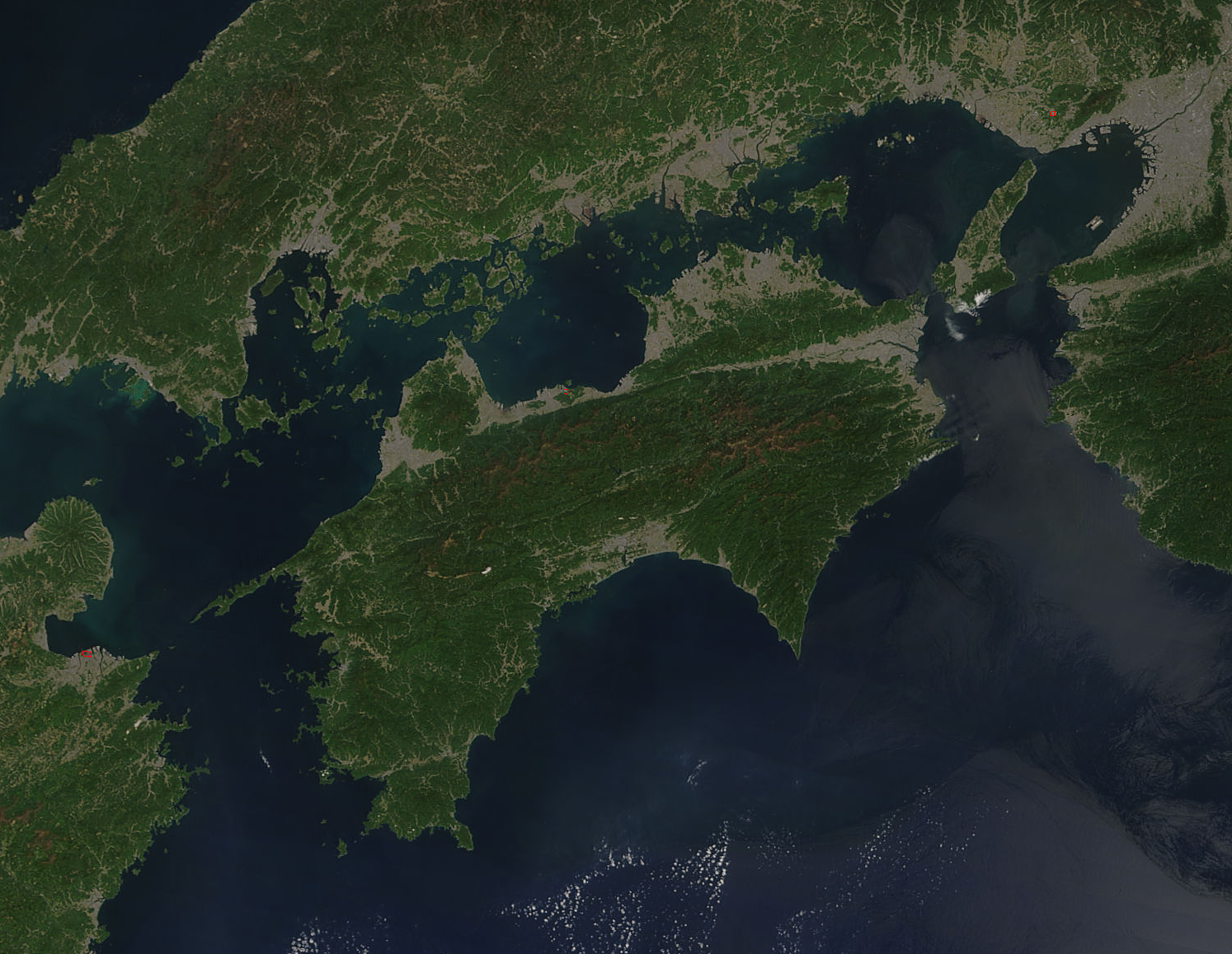
English: Satellite image of Shikoku on 21 April 2018. Each red hot spot is an area where the thermal bands on the MODIS instruments detected areas where the temperature is substantial higher than background.
日本語: 2018年4月21日の四国の衛星画像。 |
| Dyddiad | |
| Ffynhonnell | MODIS NASA - https://modis.gsfc.nasa.gov/gallery/individual.php?db_date=2018-04-27 |
| Awdur | Jeff Schmaltz, MODIS Land Rapid Response Team, NASA GSFC |
| Diwygiadau eraill |

Trwyddedu
| This file is in the public domain in the United States because it was solely created by NASA. NASA copyright policy states that "NASA material is not protected by copyright unless noted". (See Template:PD-USGov, NASA copyright policy page or JPL Image Use Policy.) | ||
 |
Warnings:
|
Hanes y ffeil
Cliciwch ar ddyddiad / amser i weld y ffeil fel ag yr oedd bryd hynny.
| Dyddiad / Amser | Bawdlun | Hyd a lled | Defnyddiwr | Sylw | |
|---|---|---|---|---|---|
| cyfredol | 00:52, 13 Ebrill 2022 | | 1,494 × 1,158 (1.98 MB) | Artanisen | Uploaded a work by Jeff Schmaltz, MODIS Land Rapid Response Team, NASA GSFC from MODIS NASA - https://modis.gsfc.nasa.gov/gallery/individual.php?db_date=2018-04-27 with UploadWizard |
Cysylltiadau'r ffeil
Mae'r 1 tudalennau a ddefnyddir isod yn cysylltu i'r ddelwedd hon:
Defnydd cydwici y ffeil
Mae'r wicis eraill hyn yn defnyddio'r ffeil hon:
- Y defnydd ar af.wikipedia.org
- Y defnydd ar ar.wikipedia.org
- Y defnydd ar arz.wikipedia.org
- Y defnydd ar ast.wikipedia.org
- Y defnydd ar ban.wikipedia.org
- Y defnydd ar br.wikipedia.org
- Y defnydd ar ca.wikipedia.org
- Y defnydd ar ceb.wikipedia.org
- Y defnydd ar da.wikipedia.org
- Y defnydd ar de.wikipedia.org
- Y defnydd ar de.wikivoyage.org
- Y defnydd ar en.wikipedia.org
- Y defnydd ar es.wikipedia.org
- Y defnydd ar eu.wikipedia.org
- Y defnydd ar fr.wikipedia.org
- Y defnydd ar fr.wikivoyage.org
- Y defnydd ar ga.wikipedia.org
- Y defnydd ar gl.wikipedia.org
- Y defnydd ar hak.wikipedia.org
- Y defnydd ar ha.wikipedia.org
- Y defnydd ar he.wikipedia.org
- Y defnydd ar hu.wikipedia.org
- Y defnydd ar hy.wikipedia.org
- Y defnydd ar it.wikipedia.org
- Y defnydd ar kk.wikipedia.org
- Y defnydd ar ko.wikipedia.org
- Y defnydd ar ku.wikipedia.org
- Y defnydd ar ml.wikipedia.org
- Y defnydd ar ms.wikipedia.org
- Y defnydd ar nn.wikipedia.org
- Y defnydd ar no.wikipedia.org
- Y defnydd ar pl.wikipedia.org
- Y defnydd ar pt.wikipedia.org
- Y defnydd ar ro.wikipedia.org
- Y defnydd ar ru.wikipedia.org
- Y defnydd ar si.wikipedia.org
- Y defnydd ar sw.wikipedia.org
- Y defnydd ar tr.wikipedia.org
- Y defnydd ar uk.wikipedia.org
- Y defnydd ar ur.wikipedia.org
- Y defnydd ar vi.wikipedia.org
- Y defnydd ar www.wikidata.org