
Delwedd:PlantMapper distribution map for Dittrichia graveolens (Stinkwort) in California, by County.jpg

Maint y rhagolwg: 600 × 600 picsel. Eglurdebau eraill: 240 × 240 picsel | 480 × 480 picsel | 768 × 768 picsel | 1,024 × 1,024 picsel | 1,500 × 1,500 picsel.
Maint llawn ((1,500 × 1,500 picsel, maint y ffeil: 156 KB, ffurf MIME: image/jpeg))
_in_California,_by_County.jpg)
Crynodeb
| Disgrifiad |
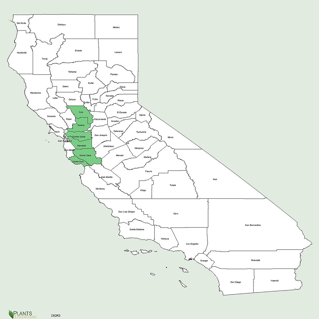
English: PlantMapper distribution map for Dittrichia graveolens (Stinkwort) in California, by County, showing 6 counties it is present in: Yolo, Solano, Contra Costa, Alameda, Santa Clara, Santa Cruz. Generated by Plantsdatabase at USDA PLANTS Profile website |
| Dyddiad | |
| Ffynhonnell | http://plants.usda.gov/java/county?state_name=California&statefips=06&symbol=DIGR3 |
| Awdur | U. S. Department of Agriculture. |
Trwyddedu
This image or file is a work of a United States Department of Agriculture employee, taken or made as part of that person's official duties. As a work of the U.S. federal government, the image is in the public domain.
|
 |
Hanes y ffeil
Cliciwch ar ddyddiad / amser i weld y ffeil fel ag yr oedd bryd hynny.
| Dyddiad / Amser | Bawdlun | Hyd a lled | Defnyddiwr | Sylw | |
|---|---|---|---|---|---|
| cyfredol | 06:25, 14 Awst 2013 | | 1,500 × 1,500 (156 KB) | Mercurywoodrose | User created page with UploadWizard |
Cysylltiadau'r ffeil
Mae'r 1 tudalennau a ddefnyddir isod yn cysylltu i'r ddelwedd hon:
_in_California,_by_County.jpg)