
Delwedd:Pennines edited-1.jpg
Maint y rhagolwg: 697 × 600 picsel. Eglurdebau eraill: 279 × 240 picsel | 558 × 480 picsel | 824 × 709 picsel.
Maint llawn ((824 × 709 picsel, maint y ffeil: 57 KB, ffurf MIME: image/jpeg))
Crynodeb
| Disgrifiad |
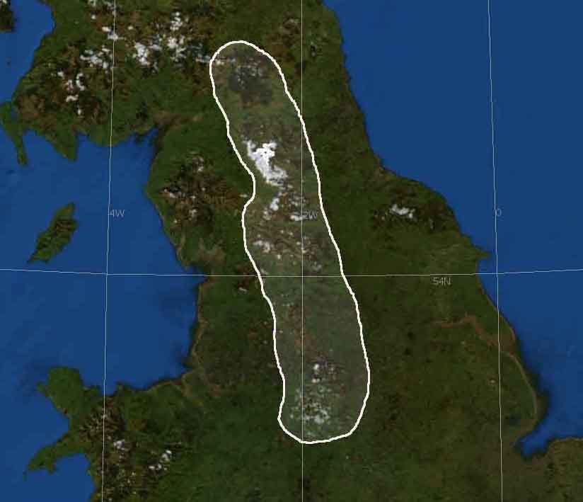
English: Base image from NASA World Wind
Edited by en:User:Harkey Lodger to show Pennines region of UK December 02 2007 |
| Ffynhonnell | Satellite imagery taken from NASA World Wind software (by screenshot) |
| Awdur | Ffotograff: NASA |
Trwyddedu
| This image is in the public domain because it is a screenshot from NASA’s globe software World Wind using a public domain layer, such as Blue Marble, MODIS, Landsat, SRTM, USGS or GLOBE.
|
 |
Cofnod lòg yr uwchlwythiad gwreiddiol
The original description page was here. All following user names refer to en.wikipedia.
- 2007-12-02 15:46 Harkey Lodger 824×709×8 (58612 bytes) {{ImageSummary}} Base image from NASA World Wind
Hanes y ffeil
Cliciwch ar ddyddiad / amser i weld y ffeil fel ag yr oedd bryd hynny.
| Dyddiad / Amser | Bawdlun | Hyd a lled | Defnyddiwr | Sylw | |
|---|---|---|---|---|---|
| cyfredol | 10:55, 23 Mehefin 2008 | | 824 × 709 (57 KB) | Powerek38 | {{Information |Description={{en|Base image from NASA World Wind Edited by en:User:Harkey Lodger to show Pennines region of UK December 02 2007}} |Source=Transferred from [http://en.wikipedia.org en.wikipedia] |Date=2007-12-02 (original upload date) | |
Cysylltiadau'r ffeil
Mae'r 1 tudalennau a ddefnyddir isod yn cysylltu i'r ddelwedd hon:
Defnydd cydwici y ffeil
Mae'r wicis eraill hyn yn defnyddio'r ffeil hon:
- Y defnydd ar ast.wikipedia.org
- Y defnydd ar be.wikipedia.org
- Y defnydd ar br.wikipedia.org
- Y defnydd ar en.wikipedia.org
- Y defnydd ar eo.wikipedia.org
- Y defnydd ar es.wikipedia.org
- Y defnydd ar fy.wikipedia.org
- Y defnydd ar gl.wikipedia.org
- Y defnydd ar hu.wikipedia.org
- Y defnydd ar hy.wikipedia.org
- Y defnydd ar id.wikipedia.org
- Y defnydd ar is.wikipedia.org
- Y defnydd ar it.wikipedia.org
- Y defnydd ar it.wikibooks.org
- Y defnydd ar ja.wikipedia.org
- Y defnydd ar kk.wikipedia.org
- Y defnydd ar ko.wikipedia.org
- Y defnydd ar kw.wikipedia.org
- Y defnydd ar ky.wikipedia.org
- Y defnydd ar nn.wikipedia.org
- Y defnydd ar no.wikipedia.org
- Y defnydd ar pl.wikipedia.org
- Y defnydd ar pl.wiktionary.org
- Y defnydd ar ru.wikipedia.org
- Y defnydd ar ta.wikipedia.org
- Y defnydd ar uk.wikipedia.org
- Y defnydd ar zh.wikipedia.org