
Delwedd:Map of Christian County Illinois.png
Wedi ei chwyddo hyd yr eithaf.
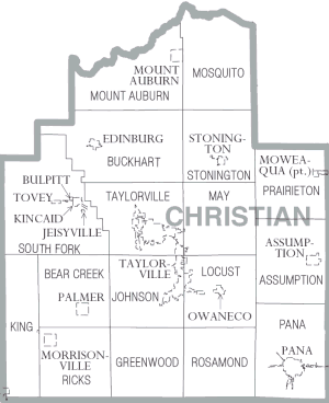
Map_of_Christian_County_Illinois.png ((300 × 368 picsel, maint y ffeil: 12 KB, ffurf MIME: image/png))
| Disgrifiad | Christian County Illinois | |||
| Dyddiad | ||||
| Ffynhonnell | https://www.census.gov\/prod/cen2000/phc-1-15.pdf | |||
| Awdur | US Census Bureau, Cropped by uploader | |||
| Caniatâd (Ailddefnyddio'r ffeil hon) |
|

Hanes y ffeil
Cliciwch ar ddyddiad / amser i weld y ffeil fel ag yr oedd bryd hynny.
| Dyddiad / Amser | Bawdlun | Hyd a lled | Defnyddiwr | Sylw | |
|---|---|---|---|---|---|
| cyfredol | 18:44, 3 Chwefror 2007 | | 300 × 368 (12 KB) | Dual Freq | {{Information |Description=Christian County Illinois |Source=http://www.census.gov/prod/cen2000/phc-1-15.pdf |Date=2000 |Author=US Census Bureau, Cropped by uploader |Permission={{PD-USGov-DOC-Census}} |other_versions= }} Category:Maps of Illinois |
Cysylltiadau'r ffeil
Nid oes tudalennau'n defnyddio'r ffeil hon.
Defnydd cydwici y ffeil
Mae'r wicis eraill hyn yn defnyddio'r ffeil hon:
- Y defnydd ar de.wikipedia.org
- Y defnydd ar en.wikipedia.org
- Y defnydd ar es.wikipedia.org
- Y defnydd ar ja.wikipedia.org
- Y defnydd ar nl.wikipedia.org
- Y defnydd ar pl.wikipedia.org