
Delwedd:Kastamonu districts.png
Maint y rhagolwg: 776 × 600 picsel. Eglurdebau eraill: 311 × 240 picsel | 621 × 480 picsel | 994 × 768 picsel | 1,056 × 816 picsel.
Maint llawn ((1,056 × 816 picsel, maint y ffeil: 39 KB, ffurf MIME: image/png))
Crynodeb
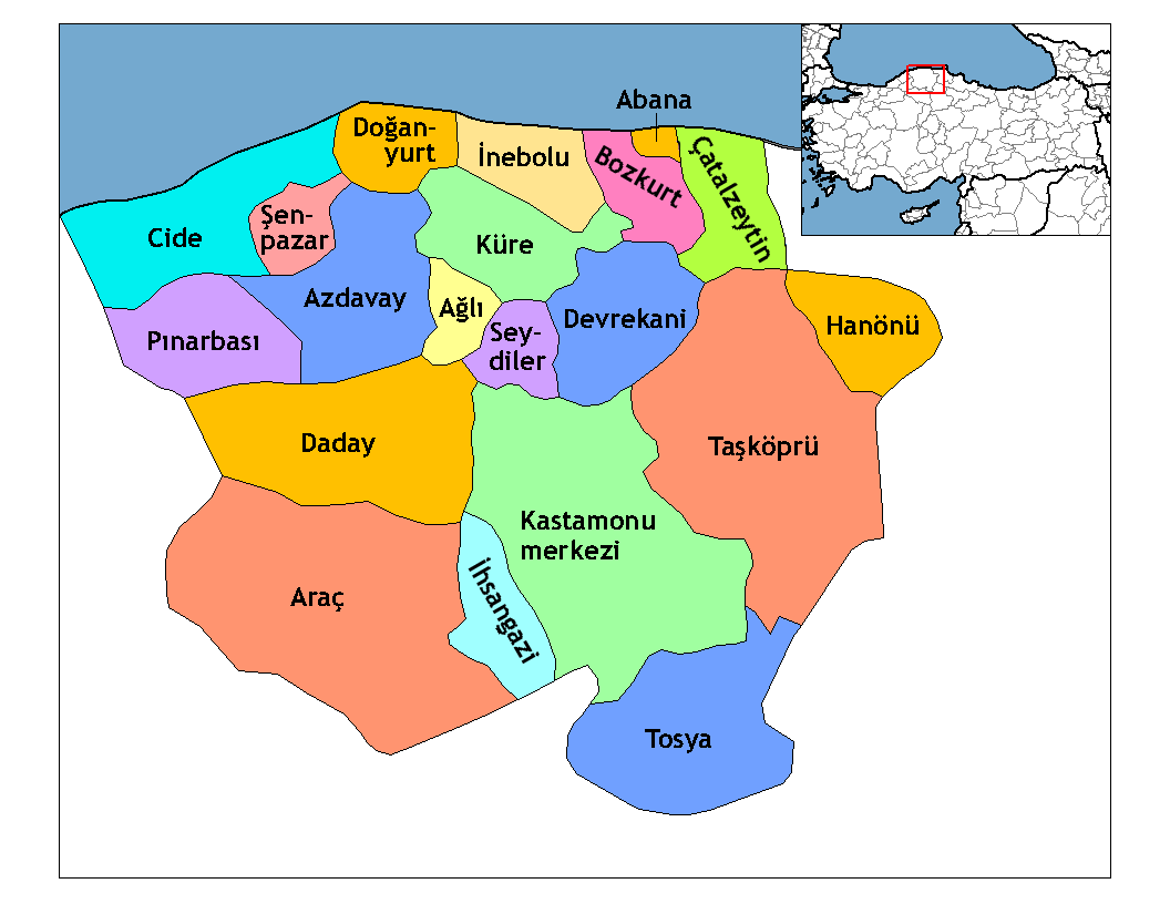
| Disgrifiad | Map of the districts of Kastamonu province in Turkey. Created by Rarelibra 21:59, 1 December 2006 (UTC) for public domain use, using MapInfo Professional v8.5 and various mapping resources. Edited by One Homo Sapiens Corrected text where İ,Ş,ı,ğ,or ş occurs in name. Source: [statoids-com]. Increased font size and enhanced color differences among adjacent districts. |
| Dyddiad | 1 Rhagfyr 2006 (original upload date) |
| Ffynhonnell | No machine-readable source provided. Own work assumed (based on copyright claims). |
| Awdur | No machine-readable author provided. Rarelibra assumed (based on copyright claims). |

|
This locator map image could be re-created using vector graphics as an SVG file. This has several advantages; see Commons:Media for cleanup for more information. If an SVG form of this image is available, please upload it and afterwards replace this template with
{{vector version available|new image name}}.
It is recommended to name the SVG file “Kastamonu districts.svg”—then the template Vector version available (or Vva) does not need the new image name parameter. |
Trwyddedu
| Yr wyf fi, deiliad hawlfraint y gwaith hwn, yn ei ryddhau i'r parth cyhoeddus, a hynny'n fyd-eang. Hwyrach nad yw hyn yn bosib yn ôl cyfraith rhai gwledydd; os felly: Rwyn rhoi i unrhywun yr hawl i ddefnyddio'r gwaith hwn at unrhyw ddiben, heb unrhyw amodau, oddieithr unrhyw amodau gofynnol yn ôl y gyfraith. |
[[Category:
]]
Hanes y ffeil
Cliciwch ar ddyddiad / amser i weld y ffeil fel ag yr oedd bryd hynny.
| Dyddiad / Amser | Bawdlun | Hyd a lled | Defnyddiwr | Sylw | |
|---|---|---|---|---|---|
| cyfredol | 23:52, 28 Rhagfyr 2008 | | 1,056 × 816 (39 KB) | One Homo Sapiens | Corrected text where İ,Ş,ı,ğ,or ş occurs in name. Source: [statoids-com]. Increased font size and enhanced color differences among adjacent districts. |
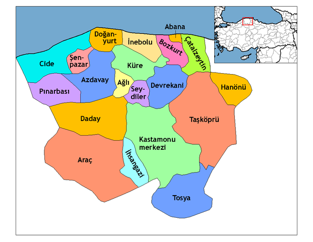
| 21:59, 1 Rhagfyr 2006 |  | 1,056 × 816 (37 KB) | Rarelibra | Map of the districts of Kastamonu province in Turkey. Created by ~~~~ for public domain use, using MapInfo Professional v8.5 and various mapping resources. |
Cysylltiadau'r ffeil
Nid oes tudalennau'n defnyddio'r ffeil hon.
Defnydd cydwici y ffeil
Mae'r wicis eraill hyn yn defnyddio'r ffeil hon:
- Y defnydd ar ar.wikipedia.org
- Y defnydd ar arz.wikipedia.org
- Y defnydd ar ast.wikipedia.org
- Y defnydd ar av.wikipedia.org
- Y defnydd ar azb.wikipedia.org
- Y defnydd ar az.wikipedia.org
- Y defnydd ar ca.wikipedia.org
- Y defnydd ar de.wikipedia.org
- Y defnydd ar diq.wikipedia.org
- Y defnydd ar el.wikipedia.org
- Y defnydd ar en.wikipedia.org
- Kastamonu Province
- User talk:Rarelibra/Maps4
- Districts of Turkey
- Governor of Kastamonu
- List of populated places in Kastamonu Province
- Abana District
- Ağlı District
- Kastamonu District
- Araç District
- Azdavay District
- Bozkurt District, Kastamonu
- Çatalzeytin District
- Cide District
- Daday District
- Devrekani District
- Doğanyurt District
- Hanönü District
- İhsangazi District
Gweld rhagor o'r defnydd cydwici o'r ffeil hon.