
Delwedd:Havre De Grace Maryland Lighthouse 600.jpg
Havre_De_Grace_Maryland_Lighthouse_600.jpg ((400 × 600 picsel, maint y ffeil: 99 KB, ffurf MIME: image/jpeg))
Crynodeb
|
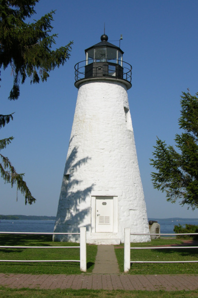
This is an image of a place or building that is listed on the National Register of Historic Places in the United States of America. Its reference number is 76000999. |
Picture of the Concord Point Lighthouse in Havre De Grace, Maryland overlooking the point where the Susquehanna River flows into the Chesapeake Bay. Photo by Derek Ramsey (Ram-Man)
Trwyddedu
You may NOT use this image on your own web site or anywhere else unless you release this image and any derivative works (which may include the web page or other medium where this image is used, if it is not considered a "collective work") by following the terms of one of the following licenses. Any other use will be considered a breach of copyright law. Please do not copy this image illegally by ignoring the terms of the license, as it is not in the public domain.
If you would like special permission to use, license, or purchase the image or prints of the image, or for use in any other fashion, or would simply like a copy of the original file, please contact me or email me first to ask. Please see the non-legalese usage guide for more information.
Note: While you are not required to do so by the license, please consider letting me know when you reuse one of my photograph images, as a courtesy.

|
Caniateir copïo, rhyddhau ac/neu addasu'r ddogfen hon yn ôl termau'r drwydded GNU Free Documentation, Fersiwn 1.2 yn unig fel ag a gyhoeddwyd gan y Free Software Foundation; heb ddim Adrannau Di-syfl, dim Testunau Clawr Blaen, a dim Testunau Clawr Cefn. Cynhwysir copi o'r drwydded hon yn yr adran GNU Free Documentation License. | 1.2 yn unig |
- Mae'n rhydd i chi:
- rhannu – gallwch gopïo, dosbarthu a throsglwyddo'r gwaith
- ailwampio – gallwch addasu'r gwaith
- Ar yr amodau canlynol:
- cydnabyddiaeth – Mae'n rhaid i chi nodi manylion y gwaith hwn, rhoi dolen i'r drwydded, a nodi os y bu golygu arni, yn y modd a benwyd gan yr awdur neu'r trwyddedwr (ond heb awgrymu o gwbl eu bod yn eich cymeradwyo chi na'ch defnydd o'r gwaith).
- rhannu ar dermau tebyg – Os byddwch yn addasu'r gwaith hwn, neu yn ei drawsnewid, neu yn adeiladu arno, mae'n rhaid i chi ddosbarthu'r gwaith dan drwydded sy'n union yr un fath same a'r gwreiddiol.
| Object location | | View this and other nearby images on: OpenStreetMap |
|---|
Hanes y ffeil
Cliciwch ar ddyddiad / amser i weld y ffeil fel ag yr oedd bryd hynny.
| Dyddiad / Amser | Bawdlun | Hyd a lled | Defnyddiwr | Sylw | |
|---|---|---|---|---|---|
| cyfredol | 03:54, 17 Gorffennaf 2005 | | 400 × 600 (99 KB) | Ram-Man | Picture of the Lighthouse in Havre De Grace, Maryland overlooking the point where the Susquehanna River flows into the Chesapeake Bay. Photo by Derek Ramsey ([[w |
Cysylltiadau'r ffeil
Mae'r 1 tudalennau a ddefnyddir isod yn cysylltu i'r ddelwedd hon:
Defnydd cydwici y ffeil
Mae'r wicis eraill hyn yn defnyddio'r ffeil hon:
- Y defnydd ar ar.wikipedia.org
- Y defnydd ar arz.wikipedia.org
- Y defnydd ar ca.wikipedia.org
- Y defnydd ar ceb.wikipedia.org
- Y defnydd ar ce.wikipedia.org
- Y defnydd ar de.wikipedia.org
- Y defnydd ar en.wikipedia.org
- Y defnydd ar en.wikivoyage.org
- Y defnydd ar es.wikipedia.org
- Y defnydd ar eu.wikipedia.org
- Y defnydd ar fa.wikipedia.org
- Y defnydd ar fr.wikipedia.org
- Y defnydd ar hu.wikipedia.org
- Y defnydd ar it.wikipedia.org
- Y defnydd ar ja.wikipedia.org
- Y defnydd ar ky.wikipedia.org
- Y defnydd ar lld.wikipedia.org
- Y defnydd ar nl.wikipedia.org
- Y defnydd ar pl.wikipedia.org
- Y defnydd ar pt.wikipedia.org
- Y defnydd ar sco.wikipedia.org
- Y defnydd ar sh.wikipedia.org
- Y defnydd ar sr.wikipedia.org
- Y defnydd ar tr.wikipedia.org
- Y defnydd ar tt.wikipedia.org
- Y defnydd ar uk.wikipedia.org
- Y defnydd ar ur.wikipedia.org
- Y defnydd ar uz.wikipedia.org
- Y defnydd ar vo.wikipedia.org
- Y defnydd ar www.wikidata.org
- Y defnydd ar zh-min-nan.wikipedia.org
- Y defnydd ar zh.wikipedia.org