
Delwedd:Glaslyn - geograph.org.uk - 56849.jpg
Wedi ei chwyddo hyd yr eithaf.
Glaslyn_-_geograph.org.uk_-_56849.jpg ((640 × 480 picsel, maint y ffeil: 95 KB, ffurf MIME: image/jpeg))
Crynodeb
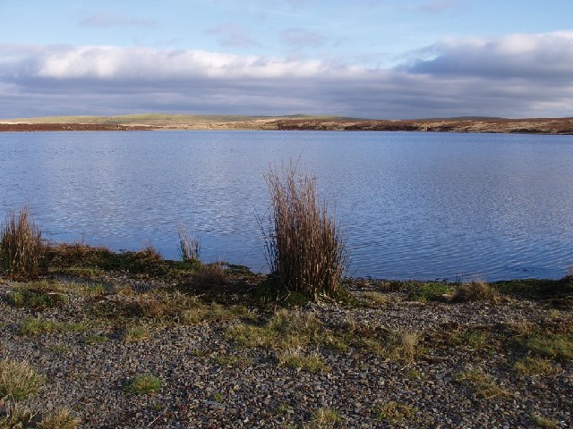
| Disgrifiad |
English: Glaslyn. Although the map suggests there is a circular path around the lake, the southern side is actually a pathless bog. The lake spreads over the southern part of the square and the north of SN822939. In the northern half of the square, the plateau ends with a steep flank down towards the Dulas and Dyfi valleys. |
| Dyddiad | |
| Ffynhonnell | From geograph.org.uk |
| Awdur | Rudi Winter |
| Cydnabyddiaeth (required by the license) | Rudi Winter / Glaslyn / |
| Camera location | | View this and other nearby images on: OpenStreetMap |
|---|
_heading:90.00&language=cy)
| Object location | | View this and other nearby images on: OpenStreetMap |
|---|
_heading:90.00&language=cy)
Trwyddedu

|
This image was taken from the Geograph project collection. See this photograph's page on the Geograph website for the photographer's contact details. The copyright on this image is owned by Rudi Winter and is licensed for reuse under the Creative Commons Attribution-ShareAlike 2.0 license.
|
Trwyddedir y ffeil hon yn ôl termau'r drwydded Creative Commons Attribution-Share Alike 2.0 Generic.
Cydnabyddiaeth: Rudi Winter
- Mae'n rhydd i chi:
- rhannu – gallwch gopïo, dosbarthu a throsglwyddo'r gwaith
- ailwampio – gallwch addasu'r gwaith
- Ar yr amodau canlynol:
- cydnabyddiaeth – Mae'n rhaid i chi nodi manylion y gwaith hwn, rhoi dolen i'r drwydded, a nodi os y bu golygu arni, yn y modd a benwyd gan yr awdur neu'r trwyddedwr (ond heb awgrymu o gwbl eu bod yn eich cymeradwyo chi na'ch defnydd o'r gwaith).
- rhannu ar dermau tebyg – Os byddwch yn addasu'r gwaith hwn, neu yn ei drawsnewid, neu yn adeiladu arno, mae'n rhaid i chi ddosbarthu'r gwaith dan drwydded sy'n union yr un fath same a'r gwreiddiol.
Hanes y ffeil
Cliciwch ar ddyddiad / amser i weld y ffeil fel ag yr oedd bryd hynny.
| Dyddiad / Amser | Bawdlun | Hyd a lled | Defnyddiwr | Sylw | |
|---|---|---|---|---|---|
| cyfredol | 15:20, 30 Ionawr 2010 | | 640 × 480 (95 KB) | GeographBot | == {{int:filedesc}} == {{Information |description={{en|1=Glaslyn. Although the map suggests there is a circular path around the lake, the southern side is actually a pathless bog. The lake spreads over the southern part of the square and the north of [[S |
Cysylltiadau'r ffeil
Mae'r 1 tudalennau a ddefnyddir isod yn cysylltu i'r ddelwedd hon:
Defnydd cydwici y ffeil
Mae'r wicis eraill hyn yn defnyddio'r ffeil hon:
- Y defnydd ar www.wikidata.org