
Delwedd:Gaborone 25.92305E 24.68895S.jpg

Maint y rhagolwg: 800 × 599 picsel. Eglurdebau eraill: 320 × 240 picsel | 640 × 479 picsel | 1,024 × 766 picsel | 1,280 × 958 picsel.
Maint llawn ((1,280 × 958 picsel, maint y ffeil: 224 KB, ffurf MIME: image/jpeg))
Crynodeb
| Disgrifiad |
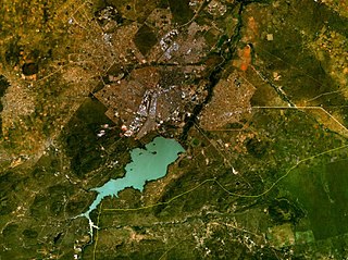
English: Gaborone, Botswana. Satellite view. |
| Dyddiad | 15 Mai 2005 (upload date) |
| Ffynhonnell | Satellite imagery taken from NASA World Wind software (by screenshot) |
| Awdur | NASA |
| Object location | | View this and other nearby images on: OpenStreetMap |
|---|
Trwyddedu
| This image is in the public domain because it is a screenshot from NASA’s globe software World Wind using a public domain layer, such as Blue Marble, MODIS, Landsat, SRTM, USGS or GLOBE.
|
 |
Hanes y ffeil
Cliciwch ar ddyddiad / amser i weld y ffeil fel ag yr oedd bryd hynny.
| Dyddiad / Amser | Bawdlun | Hyd a lled | Defnyddiwr | Sylw | |
|---|---|---|---|---|---|
| cyfredol | 09:43, 15 Mai 2005 | | 1,280 × 958 (224 KB) | Rex | NASA World Wind screenshot. {{PD-USGov-NASA}} Category:Maps of Botswana |
Cysylltiadau'r ffeil
Mae'r 1 tudalennau a ddefnyddir isod yn cysylltu i'r ddelwedd hon:
Defnydd cydwici y ffeil
Mae'r wicis eraill hyn yn defnyddio'r ffeil hon:
- Y defnydd ar am.wikipedia.org
- Y defnydd ar ar.wikipedia.org
- Y defnydd ar arz.wikipedia.org
- Y defnydd ar bg.wikipedia.org
- Y defnydd ar cs.wikipedia.org
- Y defnydd ar da.wikipedia.org
- Y defnydd ar de.wikipedia.org
- Y defnydd ar el.wikipedia.org
- Y defnydd ar en.wikipedia.org
- Y defnydd ar es.wikipedia.org
- Y defnydd ar et.wikipedia.org
- Y defnydd ar fa.wikipedia.org
- Y defnydd ar frr.wikipedia.org
- Y defnydd ar fy.wikipedia.org
- Y defnydd ar gd.wikipedia.org
- Y defnydd ar gl.wikipedia.org
- Y defnydd ar ha.wikipedia.org
- Y defnydd ar he.wikipedia.org
- Y defnydd ar hsb.wikipedia.org
- Y defnydd ar id.wikipedia.org
- Y defnydd ar it.wikipedia.org
- Y defnydd ar ja.wikipedia.org
- Y defnydd ar jv.wikipedia.org
- Y defnydd ar kn.wikipedia.org
- Y defnydd ar la.wikipedia.org
- Y defnydd ar lb.wikipedia.org
- Y defnydd ar mk.wikipedia.org
- Y defnydd ar ml.wikipedia.org
- Y defnydd ar ms.wikipedia.org
- Y defnydd ar nn.wikipedia.org
- Y defnydd ar no.wikipedia.org
- Y defnydd ar nso.wikipedia.org
- Y defnydd ar ps.wikipedia.org
- Y defnydd ar sco.wikipedia.org
- Y defnydd ar ta.wikipedia.org
- Y defnydd ar tg.wikipedia.org
- Y defnydd ar th.wikipedia.org
- Y defnydd ar tn.wikipedia.org
- Y defnydd ar tr.wikipedia.org
- Y defnydd ar vi.wikipedia.org
- Y defnydd ar yi.wikipedia.org
- Y defnydd ar yo.wikipedia.org
- Y defnydd ar zh.wikipedia.org