
Delwedd:Corra Linn - Falls of Clyde.jpg
Wedi ei chwyddo hyd yr eithaf.
Corra_Linn_-_Falls_of_Clyde.jpg ((450 × 341 picsel, maint y ffeil: 49 KB, ffurf MIME: image/jpeg))
Crynodeb
| Disgrifiad |
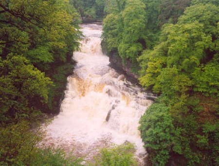
English: The Corra Linn in full spate, a sight not seen often in the year, usually only when the dam at the power station at Bonnington Linn is open to let the full force of the river spill over the falls. |
| Dyddiad | |
| Ffynhonnell | |
| Awdur | Kevin Rae |
| Caniatâd (Ailddefnyddio'r ffeil hon) |
Creative Commons Attribution Share-alike license 2.0 |

| Camera location | | View this and other nearby images on: OpenStreetMap |
|---|
| This is a retouched picture, which means that it has been digitally altered from its original version. Modifications: cropped. Modifications made by Cactus.man. The original can be found here: https://www.geograph.org.uk/photo/26709.
|
Trwyddedu
Trwyddedir y ffeil hon yn ôl termau'r drwydded Creative Commons Attribution-Share Alike 2.0 Generic.
Cydnabyddiaeth: Kevin Rae
- Mae'n rhydd i chi:
- rhannu – gallwch gopïo, dosbarthu a throsglwyddo'r gwaith
- ailwampio – gallwch addasu'r gwaith
- Ar yr amodau canlynol:
- cydnabyddiaeth – Mae'n rhaid i chi nodi manylion y gwaith hwn, rhoi dolen i'r drwydded, a nodi os y bu golygu arni, yn y modd a benwyd gan yr awdur neu'r trwyddedwr (ond heb awgrymu o gwbl eu bod yn eich cymeradwyo chi na'ch defnydd o'r gwaith).
- rhannu ar dermau tebyg – Os byddwch yn addasu'r gwaith hwn, neu yn ei drawsnewid, neu yn adeiladu arno, mae'n rhaid i chi ddosbarthu'r gwaith dan drwydded sy'n union yr un fath same a'r gwreiddiol.
Hanes y ffeil
Cliciwch ar ddyddiad / amser i weld y ffeil fel ag yr oedd bryd hynny.
| Dyddiad / Amser | Bawdlun | Hyd a lled | Defnyddiwr | Sylw | |
|---|---|---|---|---|---|
| cyfredol | 10:39, 5 Rhagfyr 2005 | | 450 × 341 (49 KB) | Cactus.man | The Corra Linn in full spate, a sight not seen often in the year, usually only when the dam at the power station at Bonnington Linn is open to let the full force of the river spill over the falls. Photograph by Kevin Rae [http://www.geograph.org.uk/photo |
Cysylltiadau'r ffeil
Mae'r 2 tudalennau a ddefnyddir isod yn cysylltu i'r ddelwedd hon:
Defnydd cydwici y ffeil
Mae'r wicis eraill hyn yn defnyddio'r ffeil hon:
- Y defnydd ar ar.wikipedia.org
- Y defnydd ar arz.wikipedia.org
- Y defnydd ar bg.wikipedia.org
- Y defnydd ar br.wikipedia.org
- Y defnydd ar ca.wikipedia.org
- Y defnydd ar ceb.wikipedia.org
- Y defnydd ar de.wikipedia.org
- Y defnydd ar en.wikipedia.org
- Y defnydd ar es.wikipedia.org
- Y defnydd ar eu.wikipedia.org
- Y defnydd ar fa.wikipedia.org
- Y defnydd ar fr.wikipedia.org
- Y defnydd ar ga.wikipedia.org
- Y defnydd ar gl.wikipedia.org
- Y defnydd ar lld.wikipedia.org
- Y defnydd ar mt.wikipedia.org
- Y defnydd ar mzn.wikipedia.org
- Y defnydd ar nn.wikipedia.org
- Y defnydd ar tg.wikipedia.org
- Y defnydd ar ur.wikipedia.org
- Y defnydd ar www.wikidata.org