
Delwedd:COLUMBIA RIVER GORGE LOOKING WEST FROM THE SUMMIT OF ROWENA HILLS BETWEEN MOSIER AND THE HOOD RIVER. BELOW, ROUTE 80N... - NARA - 548099.jpg
Maint llawn ((2,039 × 3,000 picsel, maint y ffeil: 1.47 MB, ffurf MIME: image/jpeg))
Crynodeb
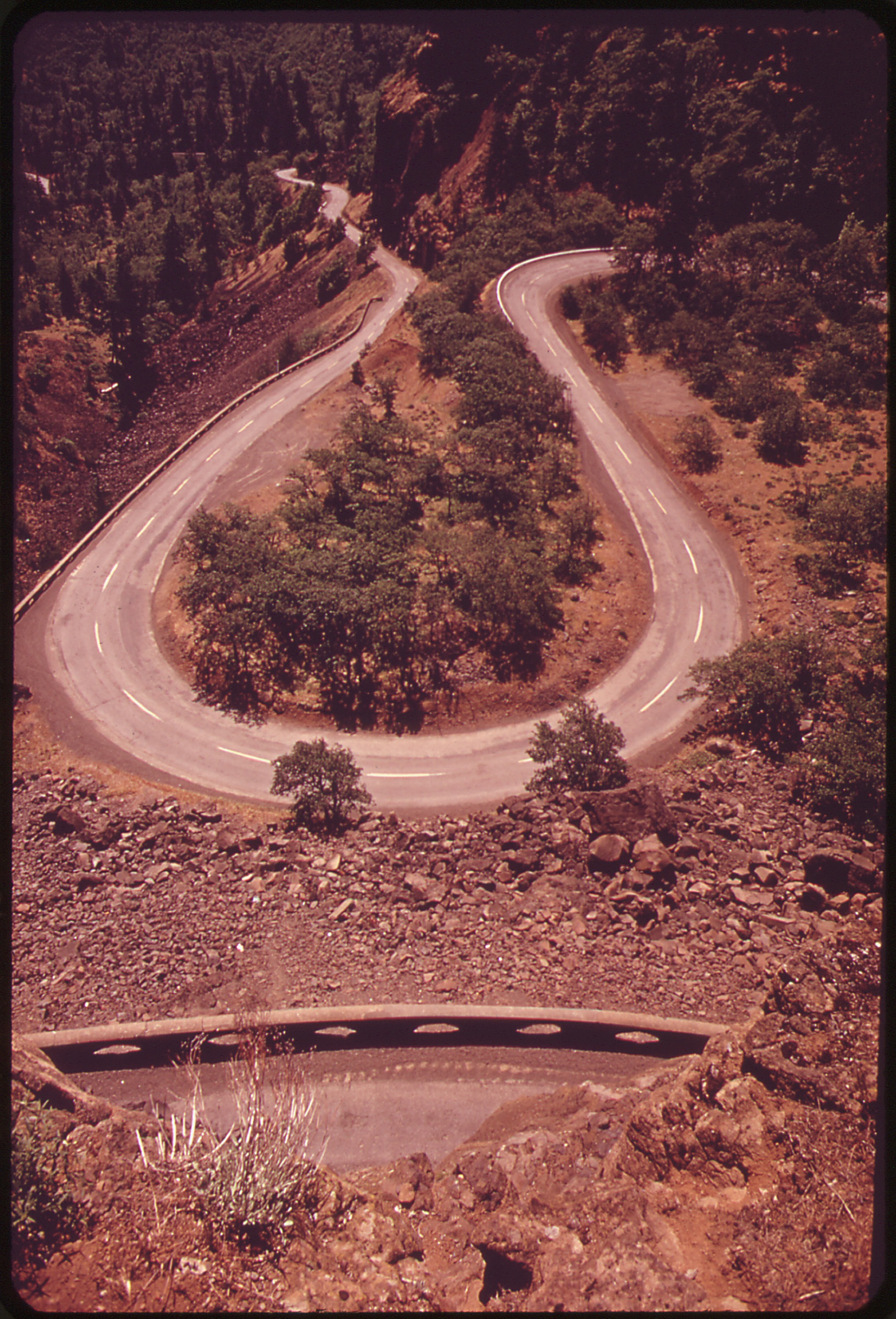
| COLUMBIA RIVER GORGE LOOKING WEST FROM THE SUMMIT OF ROWENA HILLS BETWEEN MOSIER AND THE HOOD RIVER. BELOW, ROUTE 80N DESCRIBES HAIRPIN TURN
( |
|||||||||||||||||||||||||||
|---|---|---|---|---|---|---|---|---|---|---|---|---|---|---|---|---|---|---|---|---|---|---|---|---|---|---|---|
| Awdur |
David Falconer, Photographer (NARA record: 1427627) |
||||||||||||||||||||||||||
| Record creator | Environmental Protection Agency. (12/02/1970 - ) | ||||||||||||||||||||||||||
| Teitl |
COLUMBIA RIVER GORGE LOOKING WEST FROM THE SUMMIT OF ROWENA HILLS BETWEEN MOSIER AND THE HOOD RIVER. BELOW, ROUTE 80N DESCRIBES HAIRPIN TURN |
||||||||||||||||||||||||||
| Depicted place |
The Dalles (Wasco county, Oregon, United States, North and Central America) inhabited place (45°34′59″N 121°10′12″W / 45.583°N 121.17°W; NARA geographical record) |
||||||||||||||||||||||||||
| Dyddiad | Mai 1973 | ||||||||||||||||||||||||||
| Casgliad |
|
||||||||||||||||||||||||||
| Record ID |
NAIL Control Number: NWDNS-412-DA-5612
|
||||||||||||||||||||||||||
| Ffynhonnell | |||||||||||||||||||||||||||
| Diwygiadau eraill |
Please do not overwrite this file: any cropping or other restoration work should be uploaded with a new name and linked in this page's "other versions=" parameter, so that this file represents the exact file found in the NARA catalog record to which it links. The metadata on this page was imported directly from NARA's catalog record; additional descriptive text may be added by Wikimedians to the template below with the "description=" parameter, but please do not modify the other fields. translate
|
||||||||||||||||||||||||||


.jpg)
Trwyddedu
This file was provided to Wikimedia Commons by the National Archives and Records Administration as part of a cooperation project. The National Archives and Records Administration provides images depicting American and global history which are public domain or licensed under a free license.
|
This image (or other media) is a work of an Environmental Protection Agency employee, taken or made as part of that person's official duties. As works of the U.S. federal government, all EPA images are in the public domain.
|
||
Hanes y ffeil
Cliciwch ar ddyddiad / amser i weld y ffeil fel ag yr oedd bryd hynny.
| Dyddiad / Amser | Bawdlun | Hyd a lled | Defnyddiwr | Sylw | |
|---|---|---|---|---|---|
| cyfredol | 07:53, 23 Hydref 2011 | | 2,039 × 3,000 (1.47 MB) | US National Archives bot | == {{int:filedesc}} == {{NARA-image-full | Title = COLUMBIA RIVER GORGE LOOKING WEST FROM THE SUMMIT OF ROWENA HILLS BETWEEN MOSIER AND THE HOOD RIVER. BELOW, ROUTE 80N DESCRIBES HAIRPIN TURN | Scope and content = | General no |
Cysylltiadau'r ffeil
Mae'r 1 tudalennau a ddefnyddir isod yn cysylltu i'r ddelwedd hon:
Defnydd cydwici y ffeil
Mae'r wicis eraill hyn yn defnyddio'r ffeil hon:
- Y defnydd ar fa.wikipedia.org
- Y defnydd ar ko.wikipedia.org
- Y defnydd ar ko.wikiversity.org