
Delwedd:Bikini Atoll 2001-01-14, Landsat 7 ETM+, bands 3-2-1-8.png

Maint y rhagolwg: 800 × 508 picsel. Eglurdebau eraill: 320 × 203 picsel | 640 × 406 picsel | 1,024 × 650 picsel | 1,280 × 812 picsel | 3,063 × 1,944 picsel.
Maint llawn ((3,063 × 1,944 picsel, maint y ffeil: 9.99 MB, ffurf MIME: image/png))
Crynodeb
| Disgrifiad |
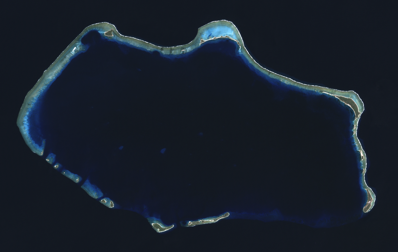
English: Composite "true color" multispectral satellite image of Bikini Atoll, Marshall Islands.
NASA Landsat 7 ETM+ bands used were 3 (red), 2 (green) and 1 (blue), and the image was pan-sharpened to 15m resolution. Imagery courtesy of NASA/USGS. |
| Dyddiad | |
| Ffynhonnell | NASA Landsat satellite image GeoTIFF archive, http://glovis.usgs.gov |
| Awdur | NASA |
| Camera location | | View this and other nearby images on: OpenStreetMap |
|---|
Trwyddedu
| This file is in the public domain in the United States because it was solely created by NASA. NASA copyright policy states that "NASA material is not protected by copyright unless noted". (See Template:PD-USGov, NASA copyright policy page or JPL Image Use Policy.) | ||
 |
Warnings:
|
| Annotations | This image is annotated: View the annotations at Commons |
Hanes y ffeil
Cliciwch ar ddyddiad / amser i weld y ffeil fel ag yr oedd bryd hynny.
| Dyddiad / Amser | Bawdlun | Hyd a lled | Defnyddiwr | Sylw | |
|---|---|---|---|---|---|
| cyfredol | 04:22, 24 Medi 2012 | | 3,063 × 1,944 (9.99 MB) | Разрывные | User created page with UploadWizard |
Cysylltiadau'r ffeil
Mae'r 1 tudalennau a ddefnyddir isod yn cysylltu i'r ddelwedd hon:
Defnydd cydwici y ffeil
Mae'r wicis eraill hyn yn defnyddio'r ffeil hon:
- Y defnydd ar af.wikipedia.org
- Y defnydd ar ar.wikipedia.org
- Y defnydd ar ast.wikipedia.org
- Y defnydd ar bn.wikivoyage.org
- Y defnydd ar ca.wikipedia.org
- Y defnydd ar ceb.wikipedia.org
- Y defnydd ar cs.wikipedia.org
- Y defnydd ar de.wikivoyage.org
- Y defnydd ar el.wikivoyage.org
- Y defnydd ar en.wikipedia.org
- Y defnydd ar en.wikivoyage.org
- Y defnydd ar eu.wikipedia.org
- Y defnydd ar fa.wikipedia.org
- Y defnydd ar fa.wikivoyage.org
- Y defnydd ar fr.wikipedia.org
- Y defnydd ar he.wikipedia.org
- Y defnydd ar hr.wikipedia.org
- Y defnydd ar hu.wikipedia.org
- Y defnydd ar id.wikipedia.org
- Y defnydd ar ik.wikipedia.org
- Y defnydd ar incubator.wikimedia.org
- Y defnydd ar it.wikipedia.org
- Y defnydd ar lv.wikipedia.org
- Y defnydd ar ms.wikipedia.org
- Y defnydd ar ne.wikipedia.org
- Y defnydd ar pl.wikipedia.org
- Y defnydd ar ru.wikipedia.org
- Y defnydd ar sh.wikipedia.org
- Y defnydd ar sr.wikipedia.org
- Y defnydd ar tr.wikipedia.org
- Y defnydd ar uk.wikipedia.org
- Y defnydd ar ur.wikipedia.org
- Y defnydd ar vi.wikipedia.org
- Y defnydd ar www.wikidata.org
- Y defnydd ar zh.wikivoyage.org