
Delwedd:Az county map.png

Maint y rhagolwg: 525 × 600 picsel. Eglurdebau eraill: 210 × 240 picsel | 568 × 649 picsel.
Maint llawn ((568 × 649 picsel, maint y ffeil: 15 KB, ffurf MIME: image/png))
Crynodeb
| Disgrifiad |
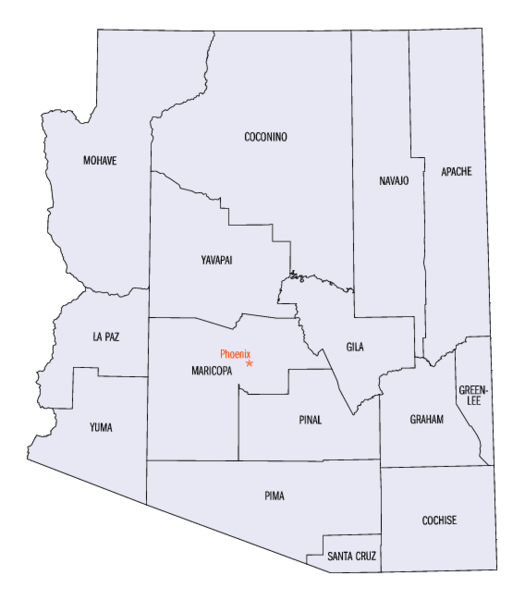
Arizona County Map Image source - [1] Was originally a gif. Converted to Az_county_map.png format. census.gov is a known en:public domain image resources. Image size 568 x 649px Disksize 15KB en:Category:Arizona maps |
||||||
| Dyddiad | Commons upload by Mdangers 16:52, 7 June 2006 (UTC) | ||||||
| Ffynhonnell |
Originally from en.wikipedia; description page is (was) here
|
||||||
| Awdur | User Buster2058 on en.wikipedia | ||||||
| Caniatâd (Ailddefnyddio'r ffeil hon) |
|
||||||
| Diwygiadau eraill | Derivative works of this file: Az county map-2.png | ||||||
Trwyddedu
This work is in the public domain in the United States because it is a work prepared by an officer or employee of the United States Government as part of that person’s official duties under the terms of Title 17, Chapter 1, Section 105 of the US Code.
Note: This only applies to original works of the Federal Government and not to the work of any individual U.S. state, territory, commonwealth, county, municipality, or any other subdivision. This template also does not apply to postage stamp designs published by the United States Postal Service since 1978. (See § 313.6(C)(1) of Compendium of U.S. Copyright Office Practices). It also does not apply to certain US coins; see The US Mint Terms of Use.
|
 | |
| Canfyddwyd bod y ffeil yn rhydd o gyfyngiadau yn ôl cyfraith hawlfraint, gan gynnwys pob hawl perthynol a chyfagos. | ||
Hanes y ffeil
Cliciwch ar ddyddiad / amser i weld y ffeil fel ag yr oedd bryd hynny.
| Dyddiad / Amser | Bawdlun | Hyd a lled | Defnyddiwr | Sylw | |
|---|---|---|---|---|---|
| cyfredol | 16:52, 7 Mehefin 2006 | | 568 × 649 (15 KB) | Mdangers | {{Information| |Description= Arizona County Map Image source - [http://quickfacts.census.gov/qfd/printmaps.html] Was originally a gif. Converted to Az_county_map.png format. census.gov is a known en:public domain image resources. Image size 568 x |
Cysylltiadau'r ffeil
Mae'r 1 tudalennau a ddefnyddir isod yn cysylltu i'r ddelwedd hon:
Defnydd cydwici y ffeil
Mae'r wicis eraill hyn yn defnyddio'r ffeil hon:
- Y defnydd ar ar.wikipedia.org
- Y defnydd ar ca.wikipedia.org
- Y defnydd ar en.wikipedia.org
- Y defnydd ar es.wikipedia.org
- Y defnydd ar fo.wikipedia.org
- Y defnydd ar frr.wikipedia.org
- Y defnydd ar fr.wikipedia.org
- Y defnydd ar he.wikipedia.org
- Y defnydd ar incubator.wikimedia.org
- Y defnydd ar it.wikipedia.org
- Y defnydd ar ja.wikipedia.org
- Y defnydd ar li.wikipedia.org
- Y defnydd ar nl.wikipedia.org
- Y defnydd ar no.wikipedia.org
- Y defnydd ar pl.wikipedia.org
- Y defnydd ar sv.wikipedia.org
- Y defnydd ar www.wikidata.org
- Y defnydd ar zh.wikipedia.org