
Delwedd:90mile beach nz landsatimage.jpg

Maint y rhagolwg: 800 × 593 picsel. Eglurdebau eraill: 320 × 237 picsel | 640 × 474 picsel | 1,024 × 758 picsel | 1,280 × 948 picsel.
Maint llawn ((1,280 × 948 picsel, maint y ffeil: 101 KB, ffurf MIME: image/jpeg))
Crynodeb
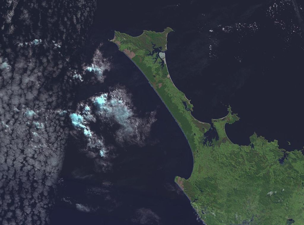
NASA World wind image of Aupouri Peninsula in New Zealand. Ninety Mile Beach, New Zealand is on the west (left) side of the peninsula.

Trwyddedu
| This image is in the public domain because it is a screenshot from NASA’s globe software World Wind using a public domain layer, such as Blue Marble, MODIS, Landsat, SRTM, USGS or GLOBE.
|
 |
derivative works
Derivative works of this file: 90mile beach nz landsatimage crop.jpg
Hanes y ffeil
Cliciwch ar ddyddiad / amser i weld y ffeil fel ag yr oedd bryd hynny.
| Dyddiad / Amser | Bawdlun | Hyd a lled | Defnyddiwr | Sylw | |
|---|---|---|---|---|---|
| cyfredol | 18:52, 1 Medi 2005 | | 1,280 × 948 (101 KB) | Klipp~commonswiki | NASA World wind image of Aupouri Peninsula in New Zealand. Ninety Mile Beach, New Zealand is on the west (left) side of the peninsula. |
Cysylltiadau'r ffeil
Mae'r 1 tudalennau a ddefnyddir isod yn cysylltu i'r ddelwedd hon:
Defnydd cydwici y ffeil
Mae'r wicis eraill hyn yn defnyddio'r ffeil hon:
- Y defnydd ar az.wikipedia.org
- Y defnydd ar bn.wikipedia.org
- Y defnydd ar ceb.wikipedia.org
- Y defnydd ar de.wikipedia.org
- Y defnydd ar de.wikivoyage.org
- Y defnydd ar en.wikipedia.org
- Y defnydd ar en.wikivoyage.org
- Y defnydd ar es.wikipedia.org
- Y defnydd ar fr.wikipedia.org
- Y defnydd ar he.wikipedia.org
- Y defnydd ar id.wikipedia.org
- Y defnydd ar it.wikipedia.org
- Y defnydd ar ko.wikipedia.org
- Y defnydd ar nn.wikipedia.org
- Y defnydd ar no.wikipedia.org
- Y defnydd ar pl.wikipedia.org
- Y defnydd ar pt.wikipedia.org
- Y defnydd ar ru.wikipedia.org
- Y defnydd ar sv.wikipedia.org
- Y defnydd ar www.wikidata.org