Bartow County, Georgia
 | |
| Math | sir |
|---|---|
| Enwyd ar ôl | Francis S. Bartow |
| Prifddinas | Cartersville, Georgia |
| Poblogaeth | 108,901 |
| Sefydlwyd | |
| Daearyddiaeth | |
| Gwlad | |
| Arwynebedd | 1,218 km² |
| Talaith | Georgia |
| Yn ffinio gyda | Gordon County, Pickens County, Cherokee County, Cobb County, Paulding County, Polk County, Floyd County |
| Cyfesurynnau | 34.24°N 84.84°W |
 | |
Sir yn nhalaith Georgia, Unol Daleithiau America yw Bartow County. Cafodd ei henwi ar ôl Francis S. Bartow. Sefydlwyd Bartow County, Georgia ym 1832 a sedd weinyddol y sir (a elwir weithiau'n 'dref sirol' neu'n 'brifddinas y sir') yw Cartersville, Georgia.
Mae ganddi arwynebedd o 1,218 cilometr sgwâr. Allan o'r arwynebedd hwn, y canran o ffurfiau dyfrol, megis llynnoedd ac afonydd, yw 2.2% . Yn ôl cyfrifiad y wlad, poblogaeth y sir yw: 108,901 (1 Ebrill 2020)[1]. Mewn cymhariaeth, yn 2016 roedd poblogaeth Caerdydd yn 361,462 a Rhyl tua 26,000.[2]
Mae'n ffinio gyda Gordon County, Pickens County, Cherokee County, Cobb County, Paulding County, Polk County, Floyd County. Cedwir rhestr swyddogol o henebion ac adeiladau cofrestredig y sir yn: National Register of Historic Places listings in Bartow County, Georgia.
 |
|
| Map o leoliad y sir o fewn Georgia |
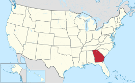
Lleoliad Georgia o fewn UDA |
Trefi mwyaf[golygu | golygu cod]
Mae gan y sir yma boblogaeth o tua 108,901 (1 Ebrill 2020)[1]. Dyma rai o'r dinasoedd, trefi neu gymunedau mwyaf poblog y sir:
Rhestr Wicidata:
| Tref neu gymuned | Poblogaeth | Arwynebedd |
|---|---|---|
| Cartersville, Georgia | 23187[3] | 75.906741[4] 75.937266[5] |
| Adairsville, Georgia | 4878[3] | 23.57923[4] |
| Euharlee, Georgia | 4268[3] | 14.401111[4] 14.050004[5] |
| Emerson, Georgia | 1415[3] | 22.593031[4] 18.954957[5] |
| Kingston, Georgia | 722[3] | 3.260018[4] 3.260033[5] |
| White, Georgia | 661[3] | 2.497566[4] 2.498265[5] |
| Taylorsville | 252[3] | 3.864923[4] 3.864926[5] |
| |||||
| ||
Cyfeiriadau[golygu | golygu cod]
- ↑ 1.0 1.1 https://data.census.gov/cedsci/table?t=Populations%20and%20People&g=0100000US,%241600000&y=2020. Cyfrifiad yr Unol Daleithiau 2020. golygydd: Biwro Cyfrifiad yr Unol Daleithiau. dyddiad cyrchiad: 1 Ionawr 2022.
- ↑ statswales.gov.wales; adalwyd 25 Mawrth 2020.
- ↑ 3.0 3.1 3.2 3.3 3.4 3.5 3.6 https://data.census.gov/cedsci/table?t=Populations%20and%20People&g=0100000US,%241600000&y=2020
- ↑ 4.0 4.1 4.2 4.3 4.4 4.5 4.6 2016 U.S. Gazetteer Files
- ↑ 5.0 5.1 5.2 5.3 5.4 5.5 2010 U.S. Gazetteer Files

