
Delwedd:Zugspitze Airview 01.jpg

Maint llawn ((2,814 × 2,111 picsel, maint y ffeil: 4.12 MB, ffurf MIME: image/jpeg))
Crynodeb
| Disgrifiad |
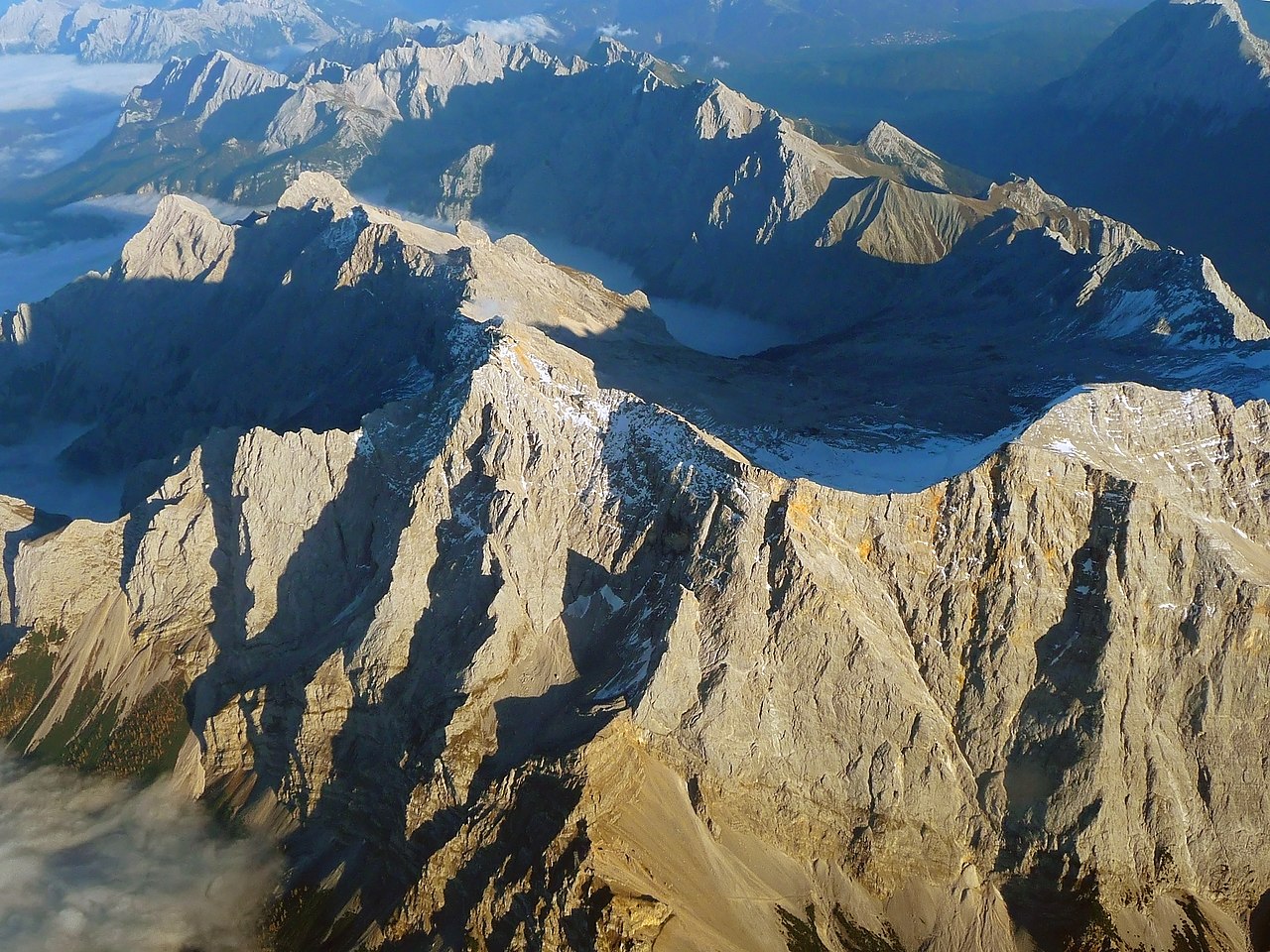
English: The "Zugspitze", the highest mountain in Germany as seen from an aircraft. View from West, with mountains in Wetterstein around and valley Reintal with fog or clouds from above.
Deutsch: Die "Zugspitze", der höchste Berg Deutschlands aus einem Flugzeug gesehen. Der Hauptgipfel des Wettersteingebirges ist umgeben von tieferliegenden Graten wie dem Jubiläumsgrat, dem Schneefernerkopf rechts neben dem Gipfel in der Mitte, mit dem Zugspitzplatt und dem steil abfallenden Reintal dahinter, die beide bereits im Schatten des späten Nachmittags liegen. Oktober mit Sonne auf dem Gipfel. |
| Dyddiad | |
| Ffynhonnell | Gwaith yr uwchlwythwr |
| Awdur | Africaspotter |
| Camera location | | View this and other nearby images on: OpenStreetMap |
|---|
Trwyddedu
- Mae'n rhydd i chi:
- rhannu – gallwch gopïo, dosbarthu a throsglwyddo'r gwaith
- ailwampio – gallwch addasu'r gwaith
- Ar yr amodau canlynol:
- cydnabyddiaeth – Mae'n rhaid i chi nodi manylion y gwaith hwn, rhoi dolen i'r drwydded, a nodi os y bu golygu arni, yn y modd a benwyd gan yr awdur neu'r trwyddedwr (ond heb awgrymu o gwbl eu bod yn eich cymeradwyo chi na'ch defnydd o'r gwaith).
- rhannu ar dermau tebyg – Os byddwch yn addasu'r gwaith hwn, neu yn ei drawsnewid, neu yn adeiladu arno, mae'n rhaid i chi ddosbarthu'r gwaith dan drwydded sy'n union yr un fath same a'r gwreiddiol.
1. Online-Medien:
2. Print-Medien:
Ich bitte um Zusendung eines Belegexemplares bzw. der URL, wo das Foto benutzt wird. Bitte schreiben Sie eine E-Mail, wenn Sie meine Adresse für die Zusendung eines Belegexemplares benötigen oder weitergehende Fragen zur Lizenznutzung haben. Eine Auswahl meiner Fotos finden Sie auch auf www.felixgottwald.net. |
1. Online media:
2. Print media:
Please send me a specimen copy or the URL of the website where the image is used. Please write an email, if you need my postal address for sending a specimen copy or have further questions regarding the terms of licence. You may also find a selection of my photos at www.felixgottwald.net. |
| Annotations | This image is annotated: View the annotations at Commons |
Hanes y ffeil
Cliciwch ar ddyddiad / amser i weld y ffeil fel ag yr oedd bryd hynny.
| Dyddiad / Amser | Bawdlun | Hyd a lled | Defnyddiwr | Sylw | |
|---|---|---|---|---|---|
| cyfredol | 19:00, 13 Hydref 2010 | | 2,814 × 2,111 (4.12 MB) | Africaspotter | {{Information |Description={{en|1=The "Zugspitze", the highest mountain in Germany as seen from an aircraft.}} {{de|1=Die "Zugspitze", der höchste Berg Deutschlands aus einem Flugzeug gesehen.}} |Source={{own}} |Author=[[User:Africaspotter|Africaspotter] |
Cysylltiadau'r ffeil
Nid oes tudalennau'n defnyddio'r ffeil hon.
Defnydd cydwici y ffeil
Mae'r wicis eraill hyn yn defnyddio'r ffeil hon:
- Y defnydd ar be.wikipedia.org
- Y defnydd ar bg.wikipedia.org
- Y defnydd ar bs.wikipedia.org
- Y defnydd ar cs.wikipedia.org
- Y defnydd ar de.wikipedia.org
- Y defnydd ar dsb.wikipedia.org
- Y defnydd ar en.wikipedia.org
- Y defnydd ar eo.wikipedia.org
- Y defnydd ar et.wikipedia.org
- Y defnydd ar eu.wikipedia.org
- Y defnydd ar fi.wikipedia.org
- Y defnydd ar fr.wikipedia.org
- Y defnydd ar gl.wikipedia.org
- Y defnydd ar he.wikipedia.org
- Y defnydd ar hsb.wikipedia.org
- Y defnydd ar hu.wikipedia.org
- Y defnydd ar id.wikipedia.org
- Y defnydd ar is.wikipedia.org
- Y defnydd ar it.wikipedia.org
- Y defnydd ar ja.wikipedia.org
- Y defnydd ar lt.wikipedia.org
- Y defnydd ar mr.wikipedia.org
- Y defnydd ar ms.wikipedia.org
- Y defnydd ar nl.wikipedia.org
- Y defnydd ar no.wikipedia.org
- Y defnydd ar pl.wikipedia.org
- Y defnydd ar pnb.wikipedia.org
- Y defnydd ar pt.wikipedia.org
- Y defnydd ar ro.wikipedia.org
- Y defnydd ar simple.wikipedia.org
- Y defnydd ar sk.wikipedia.org
- Y defnydd ar sv.wikipedia.org
- Y defnydd ar tr.wikipedia.org
- Y defnydd ar uk.wikipedia.org
- Y defnydd ar vi.wikipedia.org
- Y defnydd ar zh.wikipedia.org