
Delwedd:St Mary the Virgin, West Butterwick - geograph.org.uk - 105810.jpg
Wedi ei chwyddo hyd yr eithaf.
St_Mary_the_Virgin,_West_Butterwick_-_geograph.org.uk_-_105810.jpg ((640 × 480 picsel, maint y ffeil: 71 KB, ffurf MIME: image/jpeg))
Crynodeb
| Disgrifiad |
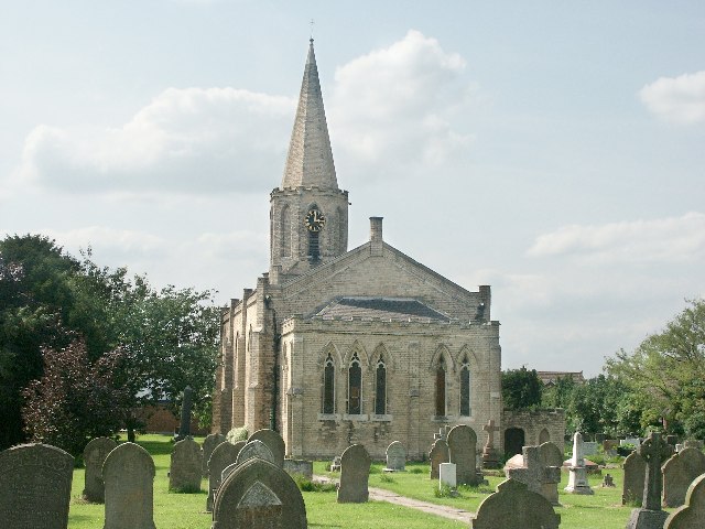
English: St Mary the Virgin, West Butterwick. Situated on the west bank of the River Trent, the Gothic church is of 1841 by Charles Briggs. |
| Dyddiad | |
| Ffynhonnell | From geograph.org.uk |
| Awdur | Dave Hitchborne |
| Cydnabyddiaeth (required by the license) | Dave Hitchborne / St Mary the Virgin, West Butterwick / |
| Camera location | | View this and other nearby images on: OpenStreetMap |
|---|
_&language=cy)
| Object location | | View this and other nearby images on: OpenStreetMap |
|---|
_&language=cy)
Trwyddedu

|
This image was taken from the Geograph project collection. See this photograph's page on the Geograph website for the photographer's contact details. The copyright on this image is owned by Dave Hitchborne and is licensed for reuse under the Creative Commons Attribution-ShareAlike 2.0 license.
|
Trwyddedir y ffeil hon yn ôl termau'r drwydded Creative Commons Attribution-Share Alike 2.0 Generic.
Cydnabyddiaeth: Dave Hitchborne
- Mae'n rhydd i chi:
- rhannu – gallwch gopïo, dosbarthu a throsglwyddo'r gwaith
- ailwampio – gallwch addasu'r gwaith
- Ar yr amodau canlynol:
- cydnabyddiaeth – Mae'n rhaid i chi nodi manylion y gwaith hwn, rhoi dolen i'r drwydded, a nodi os y bu golygu arni, yn y modd a benwyd gan yr awdur neu'r trwyddedwr (ond heb awgrymu o gwbl eu bod yn eich cymeradwyo chi na'ch defnydd o'r gwaith).
- rhannu ar dermau tebyg – Os byddwch yn addasu'r gwaith hwn, neu yn ei drawsnewid, neu yn adeiladu arno, mae'n rhaid i chi ddosbarthu'r gwaith dan drwydded sy'n union yr un fath same a'r gwreiddiol.
Hanes y ffeil
Cliciwch ar ddyddiad / amser i weld y ffeil fel ag yr oedd bryd hynny.
| Dyddiad / Amser | Bawdlun | Hyd a lled | Defnyddiwr | Sylw | |
|---|---|---|---|---|---|
| cyfredol | 01:53, 31 Ionawr 2010 | | 640 × 480 (71 KB) | GeographBot | == {{int:filedesc}} == {{Information |description={{en|1=St Mary the Virgin, West Butterwick. Situated on the west bank of the River Trent, the Gothic church is of 1841 by Charles Briggs.}} |date=2004-06-23 |source=From [http://www.geograph.org.uk/photo/1 |
Cysylltiadau'r ffeil
Mae'r 1 tudalennau a ddefnyddir isod yn cysylltu i'r ddelwedd hon:
Defnydd cydwici y ffeil
Mae'r wicis eraill hyn yn defnyddio'r ffeil hon:
- Y defnydd ar ceb.wikipedia.org
- Y defnydd ar en.wikipedia.org
- Y defnydd ar es.wikipedia.org
- Y defnydd ar fr.wikipedia.org
- Y defnydd ar it.wikipedia.org
- Y defnydd ar lld.wikipedia.org
- Y defnydd ar pl.wikipedia.org
- Y defnydd ar www.wikidata.org