
Delwedd:Mauretania et Numidia.jpg

Maint llawn ((3,509 × 1,383 picsel, maint y ffeil: 494 KB, ffurf MIME: image/jpeg))
Crynodeb
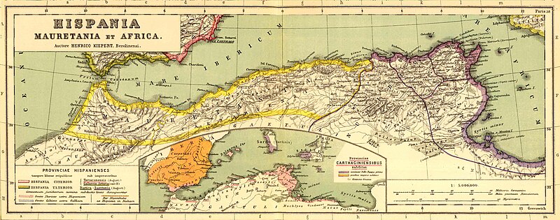
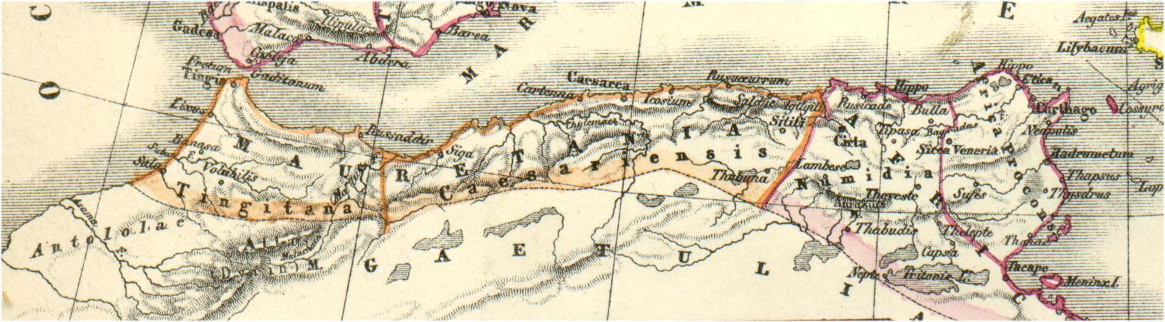
Bron: http://www.gottwein.de/latine/map/imp01_afr_nw.jpg
Autor: H.Kiepert, Atlas antiquus, Berlin (Reimer) o.J.
Trwyddedu
|
This work is in the public domain in its country of origin and other countries and areas where the copyright term is the author's life plus 70 years or fewer.
| |
| Canfyddwyd bod y ffeil yn rhydd o gyfyngiadau yn ôl cyfraith hawlfraint, gan gynnwys pob hawl perthynol a chyfagos. | |
Hanes y ffeil
Cliciwch ar ddyddiad / amser i weld y ffeil fel ag yr oedd bryd hynny.
| Dyddiad / Amser | Bawdlun | Hyd a lled | Defnyddiwr | Sylw | |
|---|---|---|---|---|---|
| cyfredol | 16:54, 3 Ionawr 2011 | 3,509 × 1,383 (494 KB) | Profburp | Meilleure définition. Extrait de la carte: Hispania, Mauretania et Africa. (with) Carthago. (with) Provinciae Carthaginiensibus subditae. Auctore Henrico Kiepert Berolinensi. Geographische Verlagshandlung Dietrich Reimer (Ernst Vohsen) Berlin, Wilhemlstr | |
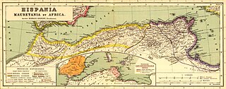
| 18:23, 13 Mai 2006 | 1,638 × 454 (175 KB) | Rodriguillo | {{nl|Uit: H.Kiepert, Atlas antiquus, Berlin (Reimer) o.J. Bron: http://www.gottwein.de/latine/map/imp01_afr_nw.jpg Kaart met de ''provinciae'' Mauretania Tingitana, Mauretania Caesariensis en Numidia.}} {{es|Mapa de las provincias roman |
Cysylltiadau'r ffeil
Mae'r 3 tudalennau a ddefnyddir isod yn cysylltu i'r ddelwedd hon:
Defnydd cydwici y ffeil
Mae'r wicis eraill hyn yn defnyddio'r ffeil hon:
- Y defnydd ar am.wikipedia.org
- Y defnydd ar ar.wikipedia.org
- تيزي وزو
- ولاية أدرار
- ولاية سوق أهراس
- مستخدم:Tarawneh/test1
- موريطنية الطنجية
- يوبا الثاني
- المغرب
- طاغاست
- مستخدم:FShbib/نموذج الصفحة الرئيسية 4
- العصر الكلاسيكي بالمغرب
- ويكيبيديا:هل تعلم/قائمة/75
- مستخدم:ASammour/الرئيسية
- زوكابار
- مستخدم:حمزة الزاهر
- سوق أهراس
- مستخدم:Hcigerga
- حدود موريطنية
- ويكيبيديا:هل تعلم/قائمة شاملة
- مستخدم:FShbib/مشاريع/الصفحة الرئيسية 2020
- مستخدم:FShbib/مشاريع/الصفحة الرئيسية 2020 (2)
- مستخدم:FShbib/مشاريع/الصفحة الرئيسية 2020 (3)
- مستخدم:Ibrahim.ID/الصفحة الرئيسية
- مستخدم:FShbib/مشاريع/الصفحة الرئيسية 2020 (4)
- مستخدم:Aminebenamoor
- مستخدم:FShbib/مشاريع/الصفحة الرئيسية 2022
- مستخدم:لوقا/الصفحة الرئيسية
- Y defnydd ar ary.wikipedia.org
- Y defnydd ar ast.wikipedia.org
- Y defnydd ar azb.wikipedia.org
- Y defnydd ar az.wikipedia.org
- Y defnydd ar be.wikipedia.org
- Y defnydd ar br.wikipedia.org
- Y defnydd ar ca.wikipedia.org
- Y defnydd ar ckb.wikipedia.org
- Y defnydd ar cs.wikipedia.org
- Y defnydd ar de.wikipedia.org
- Y defnydd ar en.wikipedia.org
Gweld rhagor o'r defnydd cydwici o'r ffeil hon.