
Delwedd:Ionian Islands.svg

Maint rhagolwg PNG o ffeil SVG yw: 532 × 547 picsel. Eglurdebau eraill: 233 × 240 picsel | 467 × 480 picsel | 747 × 768 picsel | 996 × 1,024 picsel | 1,992 × 2,048 picsel.
Maint llawn (Ffeil SVG, maint mewn enw 532 × 547 picsel, maint y ffeil: 281 KB)

|
This map has been uploaded by Electionworld from en.wikipedia.org to enable the |
Crynodeb
| Disgrifiad |
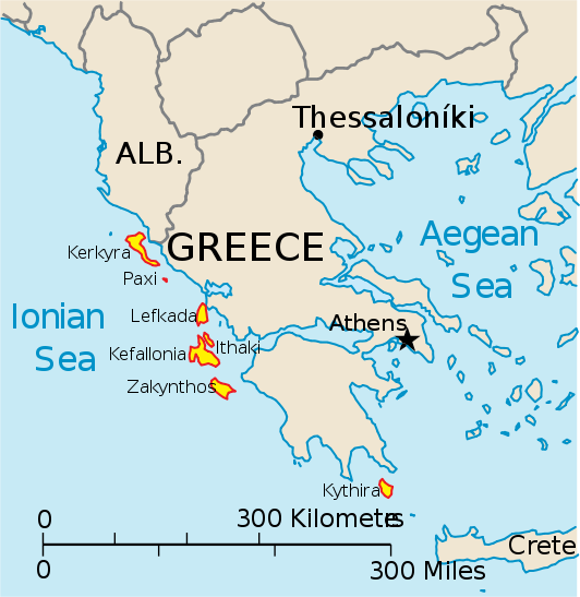
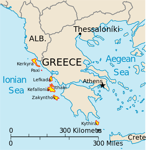
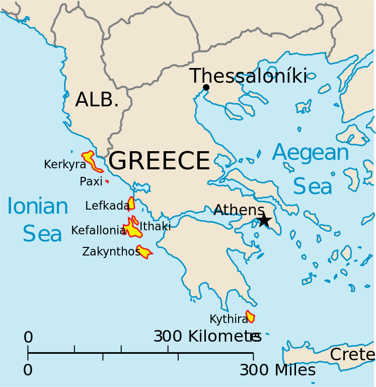
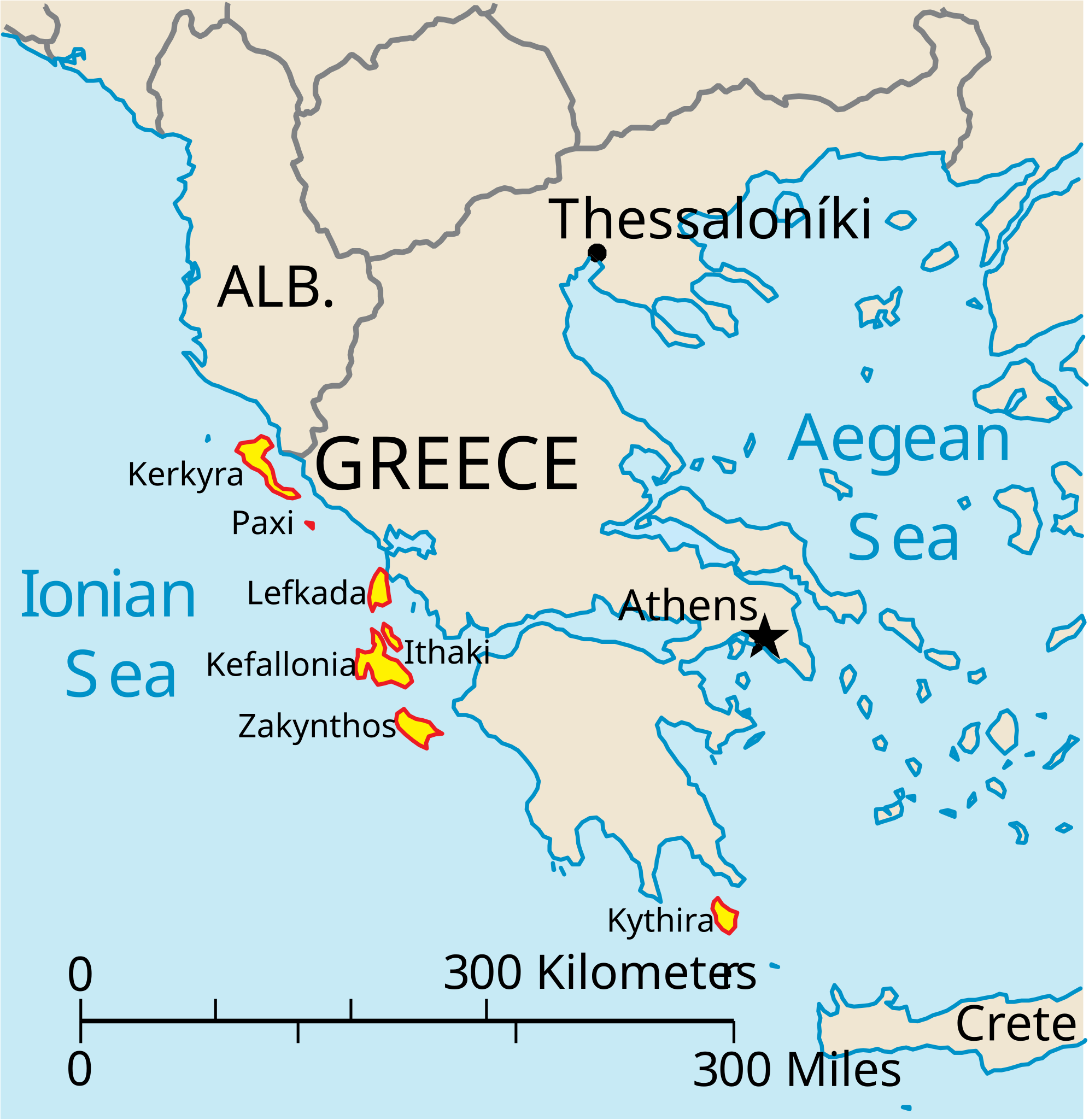
English: Map of the Ionian Islands off Greece. |
| Dyddiad | |
| Ffynhonnell | Gwaith yr uwchlwythwr, Original vector data taken from the 2006 CIA World Factbook map of Europe. All modifications were made by me, and are free for anyone to use for any purpose. |
| Awdur | Electionworld |
| Diwygiadau eraill |
Version en français : |
Trwyddedu
This image is in the public domain because it contains materials that originally came from the United States Central Intelligence Agency's World Factbook.
|
 |
Hanes y ffeil
Cliciwch ar ddyddiad / amser i weld y ffeil fel ag yr oedd bryd hynny.
| Dyddiad / Amser | Bawdlun | Hyd a lled | Defnyddiwr | Sylw | |
|---|---|---|---|---|---|
| cyfredol | 14:39, 4 Ebrill 2010 | | 532 × 547 (281 KB) | Kmusser | rm Macedonia label, not important to the map and avoids POV issue |
| 20:17, 20 Rhagfyr 2006 |  | 532 × 547 (258 KB) | Electionworld | {{ew|en|IMeowbot}} == Summary == Map of the Ionian Islands off Greece. Original vector data taken from the 2006 CIA World Factbook map of Europe. All modifications were made by me, and are free for anyone to use for any purpose. == Licensing == {{PD-US |
Cysylltiadau'r ffeil
Mae'r 1 tudalennau a ddefnyddir isod yn cysylltu i'r ddelwedd hon:
Defnydd cydwici y ffeil
Mae'r wicis eraill hyn yn defnyddio'r ffeil hon:
- Y defnydd ar ar.wikipedia.org
- Y defnydd ar ast.wikipedia.org
- Y defnydd ar be.wikipedia.org
- Y defnydd ar bg.wikipedia.org
- Y defnydd ar ceb.wikipedia.org
- Y defnydd ar ce.wikipedia.org
- Y defnydd ar da.wikipedia.org
- Y defnydd ar de.wikipedia.org
- Y defnydd ar en.wikipedia.org
- Y defnydd ar et.wikipedia.org
- Y defnydd ar fa.wikipedia.org
- Y defnydd ar fi.wikipedia.org
- Y defnydd ar fr.wikipedia.org
- Y defnydd ar he.wikipedia.org
- Y defnydd ar hr.wikipedia.org
- Y defnydd ar hu.wikipedia.org
- Y defnydd ar hyw.wikipedia.org
- Y defnydd ar id.wikipedia.org
- Y defnydd ar it.wikipedia.org
Gweld rhagor o'r defnydd cydwici o'r ffeil hon.