
Delwedd:Gyrn Ddu - geograph.org.uk - 157536.jpg
Wedi ei chwyddo hyd yr eithaf.
Gyrn_Ddu_-_geograph.org.uk_-_157536.jpg ((640 × 417 picsel, maint y ffeil: 73 KB, ffurf MIME: image/jpeg))
Crynodeb
| Disgrifiad |
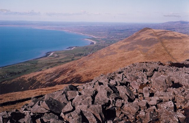
English: Gyrn Ddu A summit comprising boulders. Anglesey can be seen as the eye follows the coastline. |
| Dyddiad | |
| Ffynhonnell | From geograph.org.uk |
| Awdur | Charles Leventon |
| Cydnabyddiaeth (required by the license) | Charles Leventon / Gyrn Ddu / |
| Camera location | | View this and other nearby images on: OpenStreetMap |
|---|
_heading:22.00&language=cy)
| Object location | | View this and other nearby images on: OpenStreetMap |
|---|
_heading:22.00&language=cy)
Trwyddedu

|
This image was taken from the Geograph project collection. See this photograph's page on the Geograph website for the photographer's contact details. The copyright on this image is owned by Charles Leventon and is licensed for reuse under the Creative Commons Attribution-ShareAlike 2.0 license.
|
Trwyddedir y ffeil hon yn ôl termau'r drwydded Creative Commons Attribution-Share Alike 2.0 Generic.
Cydnabyddiaeth: Charles Leventon
- Mae'n rhydd i chi:
- rhannu – gallwch gopïo, dosbarthu a throsglwyddo'r gwaith
- ailwampio – gallwch addasu'r gwaith
- Ar yr amodau canlynol:
- cydnabyddiaeth – Mae'n rhaid i chi nodi manylion y gwaith hwn, rhoi dolen i'r drwydded, a nodi os y bu golygu arni, yn y modd a benwyd gan yr awdur neu'r trwyddedwr (ond heb awgrymu o gwbl eu bod yn eich cymeradwyo chi na'ch defnydd o'r gwaith).
- rhannu ar dermau tebyg – Os byddwch yn addasu'r gwaith hwn, neu yn ei drawsnewid, neu yn adeiladu arno, mae'n rhaid i chi ddosbarthu'r gwaith dan drwydded sy'n union yr un fath same a'r gwreiddiol.
- Remove redundant categories and try to put this image in the most specific category/categories
- Remove this template
- The location categories are based on information from this geonames tool and this OpenStreetMap tool combined with a database. You can also have a look at this tool from mysociety.
- The topic category from Geograph was Summit (find similar images at Geograph)
Hanes y ffeil
Cliciwch ar ddyddiad / amser i weld y ffeil fel ag yr oedd bryd hynny.
| Dyddiad / Amser | Bawdlun | Hyd a lled | Defnyddiwr | Sylw | |
|---|---|---|---|---|---|
| cyfredol | 08:36, 31 Ionawr 2010 | | 640 × 417 (73 KB) | GeographBot | == {{int:filedesc}} == {{Information |description={{en|1=Gyrn Ddu A summit comprising boulders. Anglesey can be seen as the eye follows the coastline.}} |date=2006-04-10 |source=From [http://www.geograph.org.uk/photo/157536 geograph.org.uk] |author=[http |
Cysylltiadau'r ffeil
Nid oes tudalennau'n defnyddio'r ffeil hon.